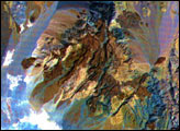
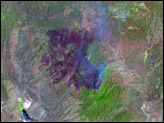
These images of the Saline Valley area, California, were acquired March 30, 2000, by the Advanced Spaceborne Thermal Emission and Reflection Radiometer (ASTER).
Published Sep 8, 2000
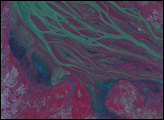
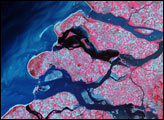
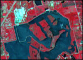
The braided streams of the Betsiboka Estuary have largely returned to their normal size, leaving puddles of blue and green water to show the extent of earlier flooding. Tropical Cyclone Gafilo moved across Madagascar on March 7 and 8, dumping heavy rain in its path. As time passed, the waters eventually flowed down the rivers to the coast, flooding the low-lying land in the west. The Advanced Spaceborne Thermal Emission and Reflection Radiometer (ASTER) on the Terra satellite captured this image of the estuary on March 20, 2004. The false-color image uses green, red, and near-infrared light (ASTER bands 3, 2, 1) so that the main river is green, other water is blue, and vegetation is red.
Published Mar 22, 2004
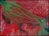
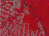
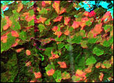
Just months after coming online, the ASTER instrument captured a view of forest clearing in Rondonia.
Published Feb 1, 2001