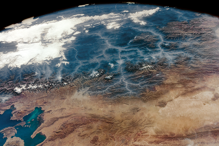
Astronauts got an oblique look at the high plains and mountains of Bolivia.
Published Feb 19, 2018
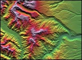
This depiction of an area south of San Martin de Los Andes, Argentina, was the first Shuttle Radar Topography Mission view of the tallest mountain chain in the western hemisphere.
Published Jun 19, 2001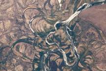
This astronaut photo from January 4, 2010, shows meander scars and oxbow lakes in the floodplain of the Rio Negro in South America.
Published Feb 15, 2010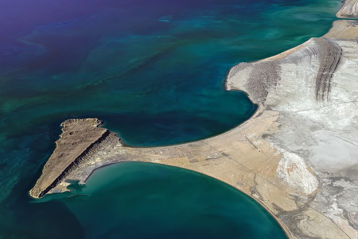
Striking geology, new ports, and a few hammerhead sharks can be found along Pakistan’s Arabian Sea coast.
Published Jul 24, 2019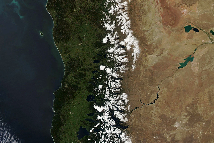
As springtime arrives in the Andes, winter snow melts to provide an important water source for local communities.
Published Oct 20, 2020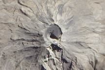
Free of vegetation, the gray and white lava-covered peak of the Ubinas Volcano looks like it could be on the Moon or some other extraterrestrial body in this detailed true-color image from July 24, 2010.
Published Feb 6, 2011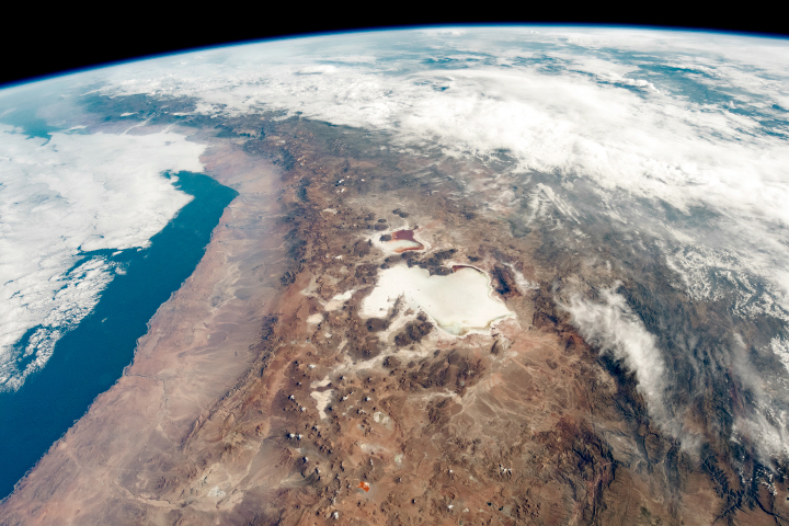
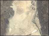
High altitudes in the Andes beget salt flats and rain shadows along the border of Chile and Bolivia.
Published Apr 14, 2019
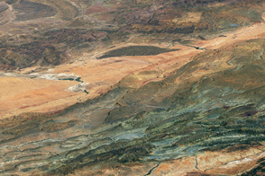
These colorful sequences of rock tell a story of geologic upheaval.
Published Jan 25, 2017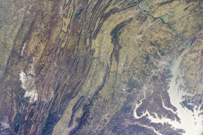
Among the oldest mountains in the world, the Appalachian chain is now relatively low but visually striking.
Published Jan 7, 2013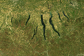
Huge sheets of ice carved out the U-shaped valleys that hold New York’s Finger Lakes. When they retreated north about 10,000 years ago, glaciers left deposits of gravel that dammed streams and caused the depressions to become lakes.
Published Nov 30, 2013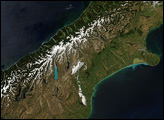
Colors ranging from deep brown to stark white give New Zealand’s South Island its intense beauty. The snow-capped Southern Alps run down the northern shore of the island. The mountains are rising as the Pacific Plate, the section of the Earth’s crust that holds the Pacific Ocean, including parts of New Zealand’s South Island, sinks beneath the Australia Plate, which holds the rest of New Zealand.
Published Dec 22, 2007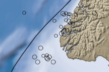
Evidence of New Zealand’s location on the Pacific Ring of Fire is shown in this image of the bathymetry (shades of blue) and topography (shades of brown) of the southwestern part of the South Island, known as Fiordland, and the surrounding waters of the Tasman Sea and Pacific Ocean.
Published Jul 21, 2009