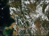
Evidence of severe flooding in Madagascar, in the wake of Tropical Cyclone Giovanna, was a sediment plume at the mouth of the Onibe River.
Published Feb 22, 2012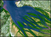
Gullies in the highlands called lavakas are a major source of sediment.
Published Feb 10, 2018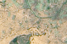
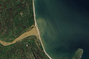
Acquired March 23, 2010, this natural-color image shows an agricultural area immediately south of the Betsiboka River, roughly 40 kilometers from the coast. The beige-and-green area filling most of the image is flooded.
Published Mar 26, 2010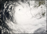
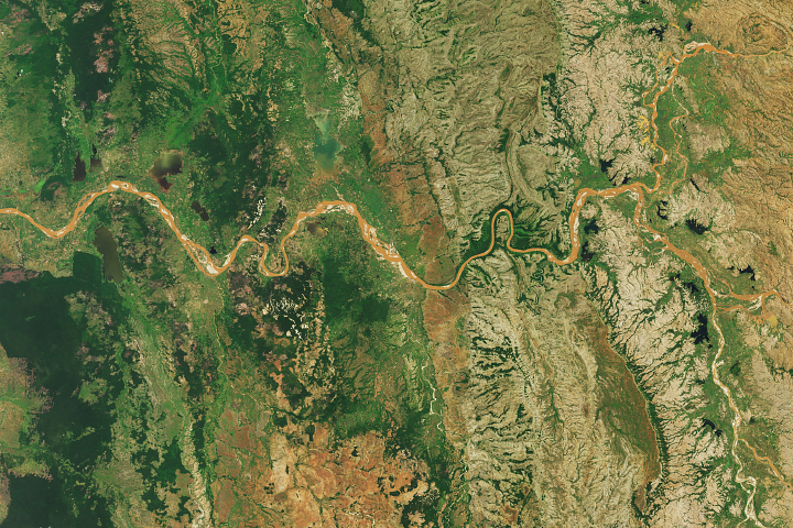
The smallest country in mainland Africa hugs its namesake river.
Published Sep 27, 2020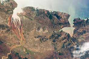
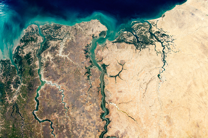
This astronaut photograph highlights two biologically productive estuaries on the coast of Madagascar.
Published Jun 13, 2011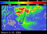
For decades, astronauts on space missions have documented land use changes around the world. Here, astronauts track the development of shrimp farming along the Honduran coastline of the Gulf of Fonseca between 1989 and 2001.
Published Jan 27, 2002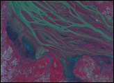
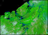
The braided streams of the Betsiboka Estuary have largely returned to their normal size, leaving puddles of blue and green water to show the extent of earlier flooding. Tropical Cyclone Gafilo moved across Madagascar on March 7 and 8, dumping heavy rain in its path. As time passed, the waters eventually flowed down the rivers to the coast, flooding the low-lying land in the west. The Advanced Spaceborne Thermal Emission and Reflection Radiometer (ASTER) on the Terra satellite captured this image of the estuary on March 20, 2004. The false-color image uses green, red, and near-infrared light (ASTER bands 3, 2, 1) so that the main river is green, other water is blue, and vegetation is red.
Published Mar 22, 2004