Acquired April 14, 2011, and March 18, 2011, these false-color images show conditions along the Red River in North Dakota, Minnesota, and Manitoba.
Published Apr 18, 2011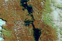
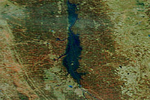
Acquired May 7, 2011, and May 14, 2010, these false-color images compare conditions along the Red River of the North.
Published May 10, 2011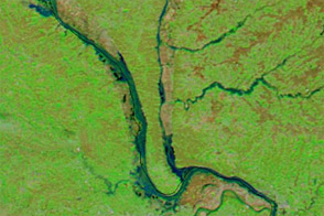
Acquired April 5 and 20, these images compare conditions along the Mississippi and Illinois Rivers, where flooding struck in the spring of 2013.
Published Apr 24, 2013
Acquired April 6, 2011, March 18, 2011, and March 7, 2011, these false-color images show melting snow and rising water levels in North Dakota, South Dakota, and Minnesota.
Published Apr 11, 2011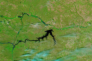
Acquired June 5, 2011, and June 16, 2010, these false-color images compare conditions along the Milk, Souris, and Missouri Rivers in Montana and North Dakota.
Published Jun 6, 2011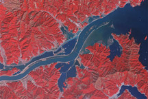
Acquired March 15, 2011, and January 16, 2011, these false-color images show part of the Kitaami River before and after the 8,9-magnitude earthquake and tsunami struck Japan in early March 2011.
Published Mar 16, 2011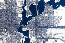
A second round of spring flooding on the Red River was captured in an astronaut photo from April 9, 2009.
Published Apr 27, 2009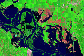
Acquired August 17, 2011, and August 1, 2011, these false-color images document the slow retreat of flood waters along the Missouri River near Blair, Nebraska.
Published Aug 23, 2011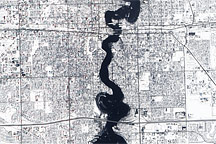
Held in place by reinforced levees, the swollen Red River snakes through Fargo, North Dakota, and Moorhead, Minnesota, in this image captured by the Advanced Land Imager on the EO-1 satellite on March 28, 2009.
Published Mar 31, 2009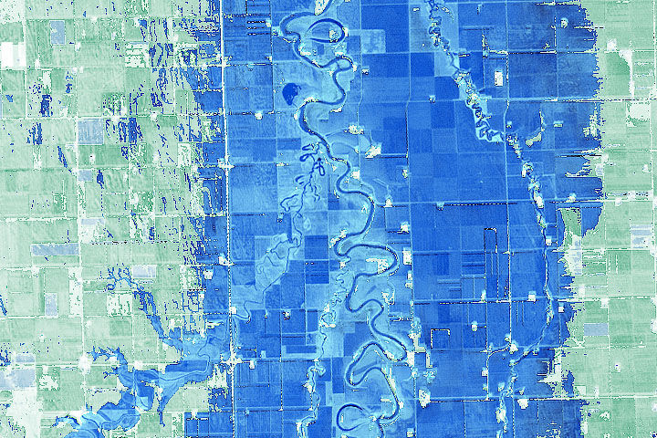
Geography and a prolonged period of wet weather have made flooding common on this river in the Northern Plains.
Published Apr 21, 2020Image of the Day Land Water Floods Human Presence Remote Sensing
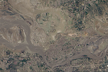
Acquired August 5, 2010, this natural-color image shows flooded crops and settlements around the Kabul River near the city of Kheshgi in northern Pakistan.
Published Aug 6, 2010