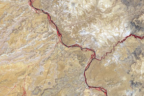
Acquired June 11, 2001, this false-color image shows the arid region where Utah, Colorado, New Mexico, and Arizona meet.
Published Sep 25, 2011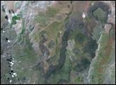
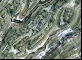
In the arid terrain of the western slopes of the Andes Mountains in southern Peru, very little vegetation exists to soften or obscure the rugged topography. In the central part of the state of Ayacucho, pictured in this satellite image, the mountains are dramatically sliced by dozens of nearly straight, parallel canyons that point southwest toward the Pacific coast.
Published Apr 10, 2008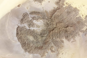
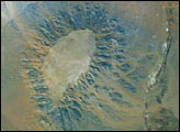
Rising from Sahara sands, the uneven peaks hold clues to a much wetter environment in the ancient past.
Published Mar 9, 2013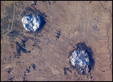
This astronaut photograph of the area to the east of Montreal, Canada, captures two striking patterns. The circular features are the central members of a group of unusual rock formations known as the Monteregian Hills: Mont St. Hilaire, Rougemont, and Mont Yamaska. The rectangular pattern blanketing the landscape in the background reveals the intensive agriculture in the fertile lowlands in southern Quebec.
Published May 28, 2007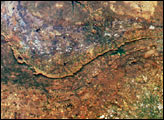
Gebel (or Mount) Edmonstone is a flat-topped mesa located near the Dahkla Oasis south of Cairo, Egypt. The Oasis is a historically important meeting place of several trade routes connecting different regions of Egypt and Sudan. Gebel Edmonstone is a remnant of an eroding scarp that extends for over 200 kilometers (125 miles) east-southeast to west-northwest (visible in the upper left corner of the image). The flat caprock of both the scarp and Mount Edmonstone is chalky limestone underlain by fossil-bearing shale and fine-grained sedimentary rocks.
Published Nov 1, 2004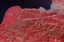
Tiny white flecks against Haiti’s plant-covered hills and mountains point to the locations of potential landslides in this false-color image from January 21, 2010.
Published Jan 21, 2010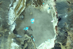
In perhaps the driest place on Earth, water still shapes the landscape.
Published Nov 29, 2011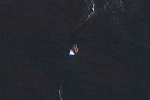
Strands of pumice curl around L’Esperance Rock, an islet in the volcanic Kermadec island chain.
Published Aug 28, 2012