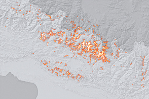
Scientists from around the world banded together to analyze landslides in the wake of a potent temblor. They found fewer scars on the landscape than past events would have predicted.
Published Dec 17, 2015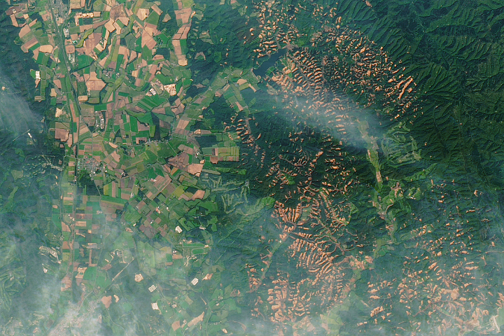
A powerful earthquake triggered hundreds of landslides on the Japanese island.
Published Oct 2, 2018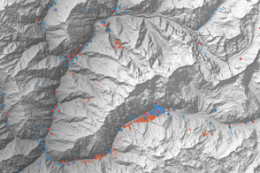
A multinational team is trying to map landslide hazards in Nepal before the summer monsoon adds to the region’s misery.
Published Jun 4, 2015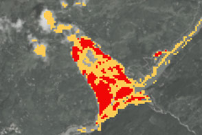
New open-source software called SLIP-DRIP uses satellite images and rainfall data to help identify otherwise overlooked landslides.
Published Jul 8, 2016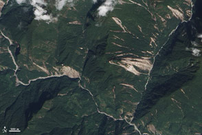
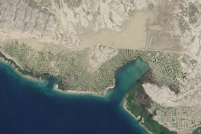
Acquired October 19, 2011, this natural-color image shows landslides in the northern Indian state of Sikkim. The landslides likely resulted from an earthquake to the northwest.
Published Oct 20, 2011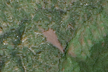
Freshly exposed earth traces down the slope of Mount Elgon in Uganda where a large landslide buried three villages on March 2, 2010. This cloud-free, natural color image is from March 11.
Published Mar 13, 2010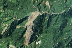
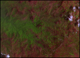
Heavy rainfall from tropical storm Komen triggered a large landslide in Myanmar (Burma).
Published Nov 8, 2015
In parts of Africa and South America, landslides are happening even if you rarely hear of them.
Published Apr 6, 2017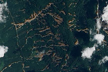
Numerous landslides mar the hills of southern Thailand in this true-color image from April 4, 2011.
Published Apr 6, 2011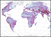

An earthquake in Indonesia made the land flow like mud in a place where science previously said it shouldn't.
Published Nov 1, 2019Image of the Day Land Water Human Presence Remote Sensing Earthquakes
A combination of seismographic data and satellite imagery is making it easier for scientists to locate elusive landslides. In summer 2013, Landsat 8 helped pinpoint a slide in eastern Alaska.
Published Aug 30, 2013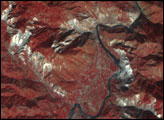
The scope of the destruction on the Caribbean island nation is so dramatic it can be seen from space.
Published Oct 15, 2016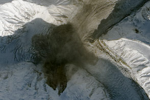
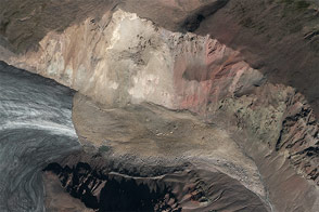
Using seismometers and satellites, scientists identified a large landslide in southwestern Yukon.
Published Oct 20, 2015

These images show changes in the landscape before and after an earthquake struck on May 12, 2008.
Published May 29, 2008