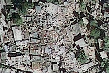
The GeoEye-1 satellite (a commercial satellite) captured these images of earthquake damage in the densely populated neighborhoods of Port-au-Prince, Haiti, on January 14, 2010.
Published Jan 15, 2010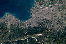
This regional view of Port-Au-Prince, Haiti, from January 15, 2010, shows the densely developed urban area and the limited number of transportation hubs available for bringing aid into the earthquake-hit nation.
Published Jan 15, 2010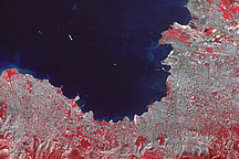
Acquired January 21, 2010, this false-color image shows Port-au-Prince nine days after a severe earthquake, as relief ships sail into the newly restored port.
Published Jan 21, 2010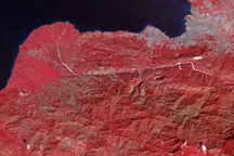
Tiny white flecks against Haiti’s plant-covered hills and mountains point to the locations of potential landslides in this false-color image from January 21, 2010.
Published Jan 21, 2010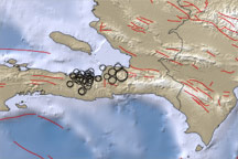
This map shows the region around the earthquake that struck the Haitian capital of Port-au-Prince on January 12, 2010. Blue areas indicate water and brown areas indicate land. Lighter colors indicate higher elevation or shallower depth. Circles indicate earthquake locations, with circle size corresponding to earthquake magnitude. Lines indicate faults.
Published Jan 13, 2010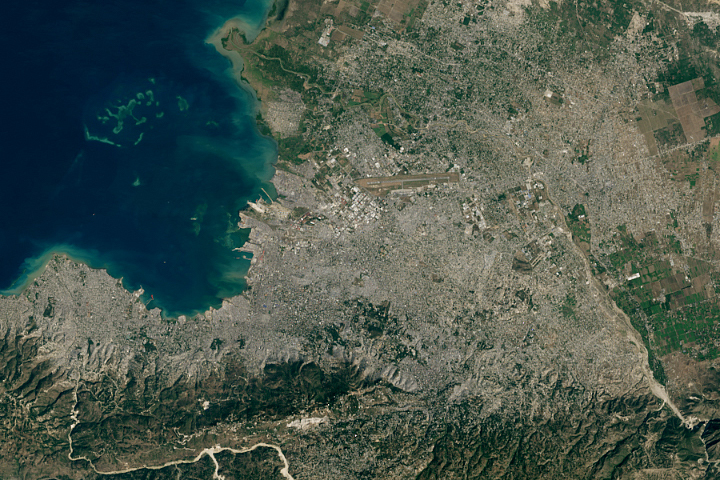
After a catastrophic earthquake left Port-au-Prince in a shambles, many people flocked to the new city of Canaan in search of a better life.
Published Jun 1, 2020
The Port of Rotterdam, also known as Europoort (Eurogate), has been an important trading center since approximately AD 1250. The history of the port reflects the evolution of the world’s economic base. Originally serving the North Sea herring fleets, it rapidly grew into a major mercantile port during the Dutch colonial period. The 19th century witnessed the Industrial Revolution, and steel and coal became major commodities passing through the port. Following the development of petroleum as a primary energy resource in the early 20th century, the port expanded westward to accommodate storage facilities and large oil tankers.
Published Jun 20, 2005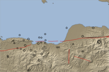
A long valley reveals the location of the Enriquillo-Plaintain Garden Fault in southern Haiti, the site of a deadly earthquake in mid-January 2010.
Published Jan 14, 2010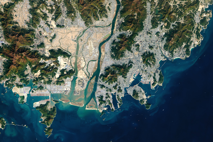
The South Korean port is among the busiest in the world.
Published Sep 5, 2018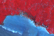
Satellite imagery reveals tsunami damage along the southern coast of Upolu, Samoa.
Published Oct 15, 2009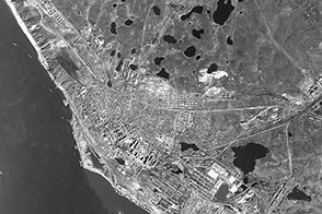
In 1966, a U.S. spy satellite captured this view of a Siberian transportation hub.
Published Jul 20, 2012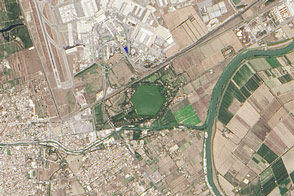
The distinctive, hexagon-shaped Trajanic Basin marks the spot of one of the Roman Empire’s great engineering achievement.
Published Mar 15, 2015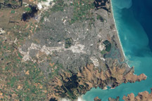
This natural color image of Christchurch, New Zealand, is overlain with a measure of the ground shaking in the area during the February 2011 earthquake.
Published Mar 9, 2011