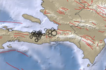
This map shows the region around the earthquake that struck the Haitian capital of Port-au-Prince on January 12, 2010. Blue areas indicate water and brown areas indicate land. Lighter colors indicate higher elevation or shallower depth. Circles indicate earthquake locations, with circle size corresponding to earthquake magnitude. Lines indicate faults.
Published Jan 13, 2010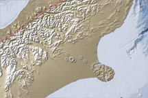
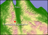
This topographic map of the South Island, New Zealand, illustrates the location of a large earthquake on September 4, 2010, how geologic activity shaped the region in the past, and why the current geology makes Christchurch vulnerable to earthquake damage.
Published Sep 7, 2010
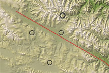
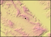
Based on data collected by the Shuttle Radar Topography Mission in 2002, this map shows the location of the April 13, 2010, earthquake in Qinghai, China, as well as tectonic features of the eastern Tibetan Plateau.
Published Apr 14, 2010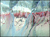
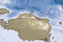
In the early morning hours of January 4, 2009, a pair of powerful earthquakes rattled Papua, Indonesia.
Published Jan 10, 2009