
This satellite map of snow cover shows that every state in the contiguous U.S., except for Florida, received snow in January 2011.
Published Feb 25, 2011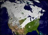
What a difference one year has made in the snow cover over North America.
Published Mar 30, 2012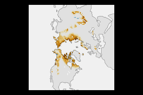
High-latitude springtime snow cover declined substantially between 1967 and 2012.
Published Jan 8, 2013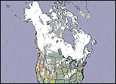
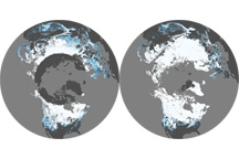
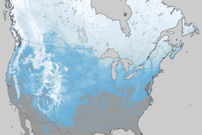
This pair of maps shows average percent snow cover in December 2008 and February 2009, the first and last months of meteorological winter in the Northern Hemisphere.
Published Mar 6, 2009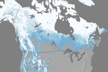
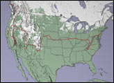
Snow cover across North America in April 2010 was the lowest since records began in 1967.
Published May 27, 2010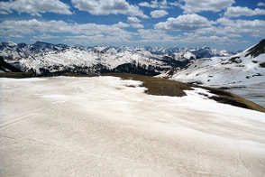
Scientist Tom Painter examines the differences between pure and dirty snow. A rise in dust can be a critical influence on snow-fed water supplies in the American West.
Published Sep 1, 2013
For the first time since 1918, snow fell in Buenos Aires, Argentina, late on July 9, 2007. The snow was still there the next morning when the Moderate Resolution Imaging Spectroradiometer (MODIS) flew over on NASA’s Terra satellite at 10:55 a.m. local time.
Published Jul 11, 2007