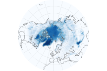
These image maps show how changes in snow and ice in the Northern Hemisphere have allowed the Earth to soak up more solar energy—and warm up—over the last 30 years.
Published Feb 24, 2011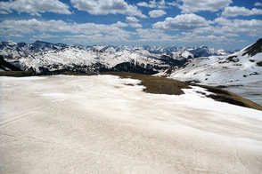
Scientist Tom Painter examines the differences between pure and dirty snow. A rise in dust can be a critical influence on snow-fed water supplies in the American West.
Published Sep 1, 2013
This satellite map of snow cover shows that every state in the contiguous U.S., except for Florida, received snow in January 2011.
Published Feb 25, 2011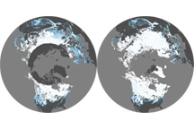
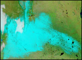
This pair of maps shows average percent snow cover in December 2008 and February 2009, the first and last months of meteorological winter in the Northern Hemisphere.
Published Mar 6, 2009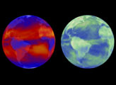
For the first time since 1918, snow fell in Buenos Aires, Argentina, late on July 9, 2007. The snow was still there the next morning when the Moderate Resolution Imaging Spectroradiometer (MODIS) flew over on NASA’s Terra satellite at 10:55 a.m. local time.
Published Jul 11, 2007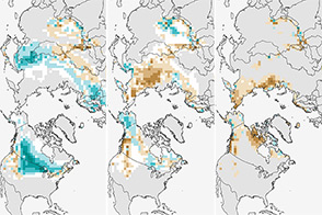
The climate of Earth is changing; fewer days of snow cover is yet another indicator.
Published Jan 3, 2014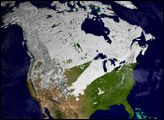
Snow and ice play an important role in keeping our planet cool, though not in the way you might think.
Published May 19, 2011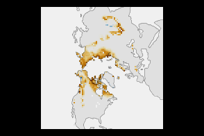
High-latitude springtime snow cover declined substantially between 1967 and 2012.
Published Jan 8, 2013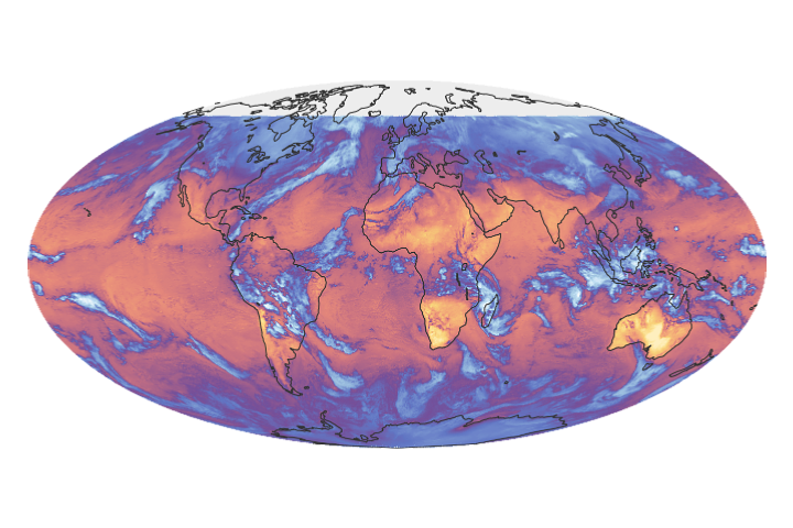
The CERES FM6 instrument measures the solar energy absorbed and reflected by Earth, the heat the planet emits into space, and the role of clouds in that process.
Published Jan 26, 2018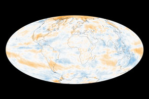
The global picture of how Earth reflects sunlight is a muddle, though several regional trends emerge.
Published Oct 21, 2014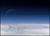
Atmospheric gases scatter blue wavelengths of visible light more than other wavelengths, giving the Earth’s visible edge a blue halo. At higher and higher altitudes, the atmosphere becomes so thin that it essentially ceases to exist. Gradually, the atmospheric halo fades into the blackness of space. This astronaut photograph captured on July 20, 2006, shows a nearly translucent moon emerging from behind the halo.
Published Feb 2, 2007