Acquired July 11, 2010, and June 21, 2010, these false-color images show northeastern Mexico before and after flooding along the Rio Salado.
Published Jul 15, 2010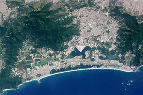
The fast-growing and affluent neighborhood of Barra da Tijuca will host much of the 2016 Olympic Games.
Published Jun 1, 2016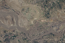
Acquired August 5, 2010, this natural-color image shows flooded crops and settlements around the Kabul River near the city of Kheshgi in northern Pakistan.
Published Aug 6, 2010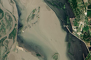
Acquired July 17, 2011, this natural-color image shows flood water lingering near Hamburg, Iowa, which avoided inundation with a new levee.
Published Jul 20, 2011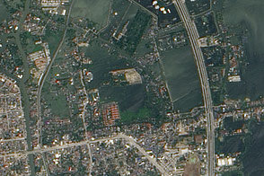
Acquired in late October and mid-November 2011, these images document the slow withdrawal of flooding from the historic city of Ayutthaya, Thailand.
Published Nov 16, 2011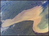
Rio de la Plata is the muddy estuary of the Paraná and Uruguay Rivers, and forms part of the border between Argentina and Uruguay. The rich estuary supports both capital cities of Buenos Aires and Montevideo. This image provides a snapshot of the complicated mixing in the Rio de la Plata between the fresh river waters and the water of the South Atlantic.
Published Dec 8, 2003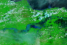
Days of heavy rain sent the Solo River in East Java over its banks, inundating thousands of homes.
Published Mar 4, 2009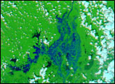
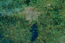
In the span of just five days, the MODIS sensor observed the snow melt and swollen rivers around Winnipeg, in Manitoba, Canada. This image shows extensive flooding on April 15, 2009.
Published Apr 16, 2009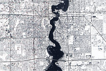
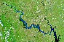
Held in place by reinforced levees, the swollen Red River snakes through Fargo, North Dakota, and Moorhead, Minnesota, in this image captured by the Advanced Land Imager on the EO-1 satellite on March 28, 2009.
Published Mar 31, 2009
Flood water continues receding from Thailand’s historic city of Ayutthaya in December 2011 and January 2012.
Published Jan 12, 2012