Hurricane Maria brought potent winds and dire warnings to Caribbean islands just two weeks after Irma devastated the region.
Published Sep 20, 2017Image of the Day Atmosphere Land Water Severe Storms Human Presence Remote Sensing
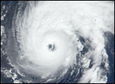
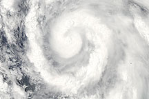
Acquired June 24, 2010, this natural-color image shows powerful Hurricane Celia over the Pacific Ocean.
Published Jun 26, 2010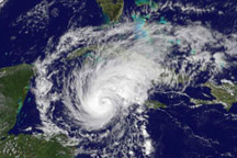
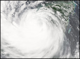
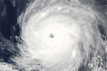
Hurricane Paloma was well-formed, with distinctive spirals and a clear eye on November 7, 2008, when the GOES satellite captured this image.
Published Nov 8, 2008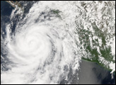
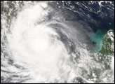
Acquired June 29, 2010, this natural-color image shows Hurricane Alex—2010’s first hurricane—spanning the Gulf of Mexico.
Published Jun 30, 2010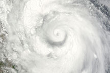
Hurricane Alex—2010’s first hurricane—sprawls across the Gulf of Mexico in this photo-like image from Wednesday, June 30, 2010.
Published Jul 1, 2010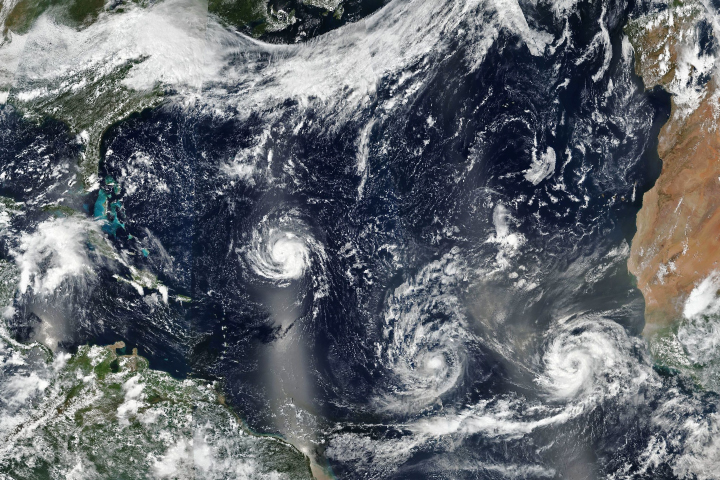
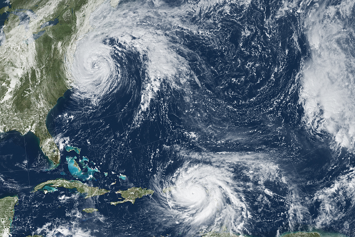
As three hurricanes churn, Florence has forecasters on edge.
Published Sep 10, 2018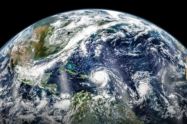
In early September 2017, hurricanes Katia, Irma, and Jose lined up across the Atlantic basin.
Published Sep 7, 2017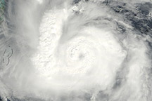
Acquired October 12, 2010, this natural-color image shows a compact but intense Hurricane Paula off the coasts of Mexico, Belize, and Honduras.
Published Oct 15, 2010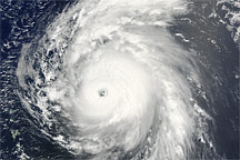
Hurricane Bill was a large Category 4 storm when this image was captured on August 19, 2009.
Published Aug 19, 2009