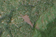
Freshly exposed earth traces down the slope of Mount Elgon in Uganda where a large landslide buried three villages on March 2, 2010. This cloud-free, natural color image is from March 11.
Published Mar 13, 2010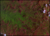
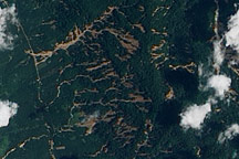
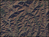
Numerous landslides mar the hills of southern Thailand in this true-color image from April 4, 2011.
Published Apr 6, 2011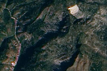
This true-color image from January 15, 2010, highlights potential new landslides near the epicenter of Haiti’s massive 7.0 earthquake.
Published Jan 19, 2010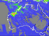
Acquired October 19, 2011, this natural-color image shows landslides in the northern Indian state of Sikkim. The landslides likely resulted from an earthquake to the northwest.
Published Oct 20, 2011
This analysis shows rainfall estimates for Manila and the surrounding region from September 21 to 27, 2009. The heaviest rainfall amounts appear in blue and the lightest amounts appear in pale green. Gray shading indicates topography.
Published Sep 29, 2009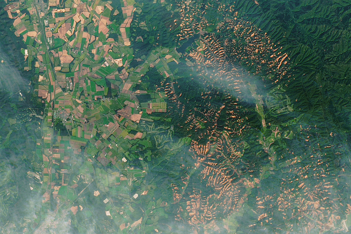
A powerful earthquake triggered hundreds of landslides on the Japanese island.
Published Oct 2, 2018
New open-source software called SLIP-DRIP uses satellite images and rainfall data to help identify otherwise overlooked landslides.
Published Jul 8, 2016
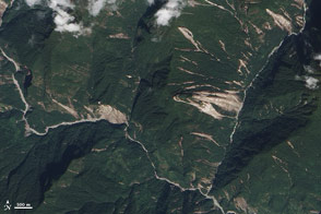
The Advanced Land Imager on EO-1 captured these true-color images of the hills north and west of Teresópolis, Brazil, where mudslides devastated the mountainous region in January 2011.
Published Feb 5, 2011