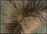
Satellite view of fresh lava flows from recent activity at Kilaue’s Pu’u O’o Crater.
Published Sep 9, 2011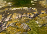
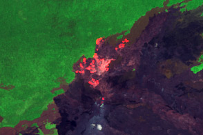
Fresh lava flows radiate from Kilauea’s Pu’su ’O’o, crater, as the Volcano’s longstanding eruption continues.
Published Nov 13, 2011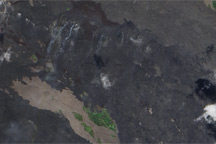
Fresh lava flows cover the slopes of Hawaii’s Kilauea Volcano.
Published Nov 4, 2010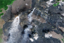
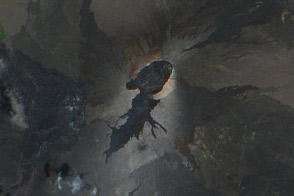
Pu'u 'O'o and the Thanksgiving Eve Breakout vent on Kilauea--two centers of volcanic activity--emit steam and other gases in this satellite image.
Published Nov 5, 2009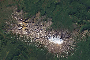
Low-viscosity lava flows produce long, narrow shapes on the landscape.
Published Nov 22, 2013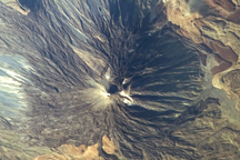
Sinuous, channelized lava flows are the most striking volcanic features visible in this astronaut photo of Teide and Viejo Volcanoes on Tenerife Island.
Published Aug 3, 2009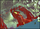
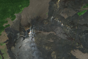
Volcanic Activity in Kilauea’s East Rift Zone is concentrated in the Kahauale’a 2 lava flow.
Published Sep 9, 2013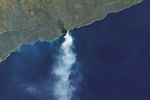
Hawaii’s Kilauea volcano rang in the new year with a sudden and dangerous collapse of a lava delta.
Published Jan 7, 2017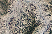
This natural-color image of Hells Canyon was captured by NASA’s Landsat-7 satellite on September 19, 2002. The image shows the northern part of the canyon, where the Imnaha River joins the Snake River.
Published Mar 8, 2009