The contrast in ocean depths between the Australia Plate and the Pacific Plate near the Solomon islands reveals the subduction of the former beneath its northeastern neighbor. This subduction was responsible for the 7.2-magnitude quake on January 4, 2010.
Published Jan 5, 2010
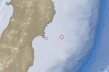
This map shows the location of a large aftershock off the coast of Japan on April 7, 2011.
Published Apr 7, 2011

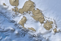
This image shows the topography, bathymetry, fault lines, and earthquake locations related to the earthquake that struck off the coast of Indonesia on October 25, 2010.
Published Oct 27, 2010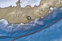
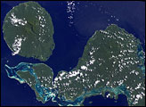
This color-coded map shows the topography, bathymetry, fault lines, and earthquake locations related to earthquakes in New Britain on July 18–19, 2010.
Published Jul 20, 2010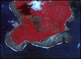

A 6.1 magnitude earthquake in Costa Rica shook the country on January 8, 2009. The event triggered landslides which killed at least 20 people.
Published Jan 16, 2009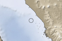
This image shows the topography and bathymetry near Sumatra, Indonesia, where hundreds or thousands of people were feared dead in the wake of a magnitude 7.6 earthquake that struck on September 30, 2009.
Published Sep 30, 2009