The city is a favorite subject for astronaut photography.
Published Mar 9, 2012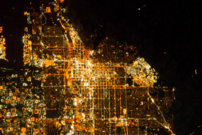
It is the capital of Utah, headquarters of the Church of Jesus Christ of Latter-day Saints, and “the crossroads of the West.”
Published Jan 6, 2014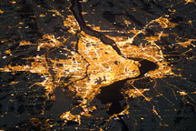
Montreal, the largest city in the mostly French-speaking Province of Quebec, is considered by some to be the cultural capital of Canada.
Published Jan 10, 2011
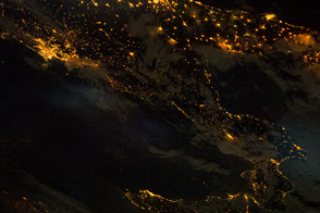
City lights trace the outline of Italy's “boot” and the island of Sicily.
Published Jul 4, 2011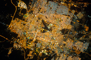
The capital city of Saudi Arabia has grown dramatically in the last half century.
Published Dec 3, 2012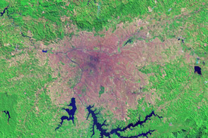
Nearly 10 percent of Brazil’s population lives in São Paulo, which ranks as the tenth largest city in the world.
Published Jul 9, 2014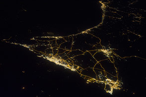
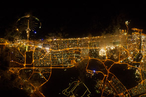
The human landscape of Arabian cities stands out clearly when you see the lights.
Published Dec 30, 2013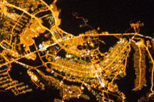
The developed areas of Brasília and its satellite cities are clearly outlined by street grids and highway lights in this astronaut photograph taken from the International Space Station.
Published Jan 31, 2011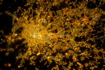
Milan, the largest city in Italy, is one of Europe’s major transportation, industrial, and commercial hubs, and a global center of fashion and culture.
Published Mar 14, 2011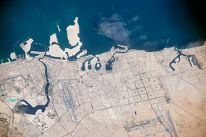
Crews aboard the International Space Station often look for signs of human activity along the coastlines of the Persian Gulf, where a growing Middle Eastern population has been moving.
Published Dec 28, 2015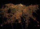
Buenos Aires is one of the larger cities seen by orbiting crews. Twelve million people, almost one third of all Argentines, live in this city, often called the “Paris of the South”.
Published Mar 16, 2003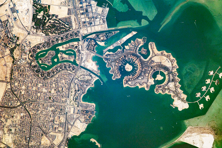
These artificial islands in Doha were built to resemble a string of pearls.
Published Apr 3, 2018
Home to one-fifth of Egypt’s population, it is the largest city in the Middle East and Africa’s second largest.
Published Apr 6, 2015
The city of Seoul (originally known as Hanyang) has been the capital of Korea for more than 600 years. This astronaut photograph illustrates the Seoul urban area at night. Major roadways and river courses (such as the Han River) are clearly outlined by street lights, while the brightest lights indicate the downtown urban core (center of image) and large industrial complexes. One such complex is located at the far left of the image and occupies an island in the Yellow Sea. Very dark regions in the image are mountains or large bodies of water. Nighttime images have been used extensively in urban climate and urban growth research to map the extent of urban (bright) versus rural (dark) regions.
Published Jan 10, 2005