Fires, bumper crops, and encephalitis could follow.
Published Mar 17, 2012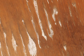
Long, parallel dunes cross borders in one of Australia’s driest deserts.
Published Oct 16, 2015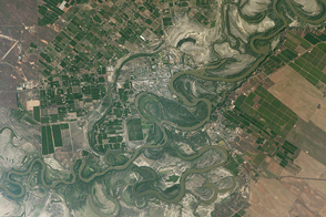
The landscape near the southern Murray River contrasts fertile farmland with dry lakes.
Published Apr 24, 2017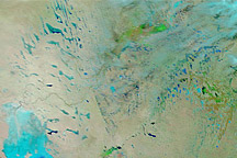
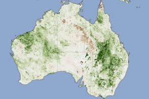
Acquired January 14, 2011, and December 29, 2010, these false-color images show changes to Australia’s interior caused by heavy rains.
Published Jan 14, 2011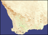
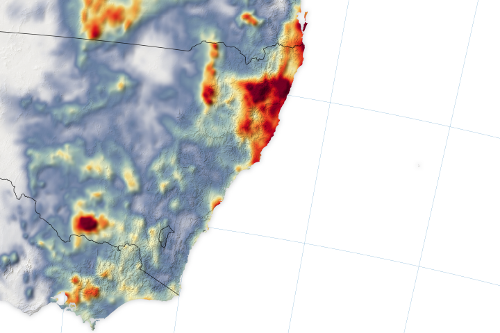
Bushfire counts dipped in mid-January when much-needed rainfall poured down on New South Wales and Victoria.
Published Jan 24, 2020Image of the Day Atmosphere Heat Land Unique Imagery Remote Sensing
Acquired on April 10, 2010, and and March 7, 2009, these natural-color images show changes in a central Australian saltpan, Lake Frome. In 2010, water has seeped into the salt lake, leaving standing water in some areas and muddying much of the ground surface.
Published Apr 14, 2010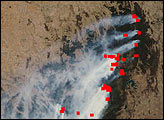
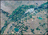
Lake McConaughy and a tan-and-green patchwork of thousands of agricultural fields dominate this astronaut photo of western Nebraska and northeastern Colorado. The astronaut who shot this view was looking towards the east-northeast, focusing on the thin, green lines of the floodplains of the North and South Platte rivers. These join to form the Platte River near image upper right.
Published Oct 8, 2007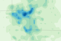
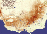
This color-coded image shows total rainfall amounts in Australia from February 7 to 13, 2010. Light green indicates the lightest amounts and dark blue indicates the heaviest amounts.
Published Feb 16, 2010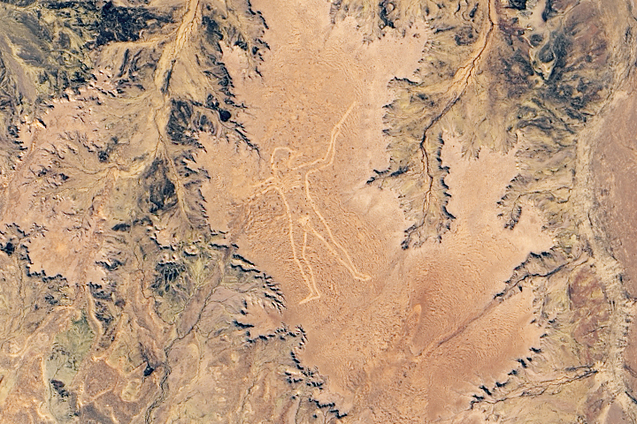
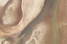
It is unclear who created the giant geoglyph or why, but the large earthen figure has drawn attention to a remote part of South Australia for two decades.
Published Dec 29, 2019
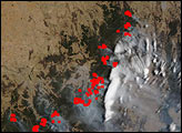
Fire managers warned of “the most dangerous bushfire week this nation has ever seen.”
Published Nov 11, 2019Image of the Day Heat Land Drought Fires Human Presence Remote Sensing