
By changing a percentage, institutions can take some forested lands off the map.
Published Dec 18, 2015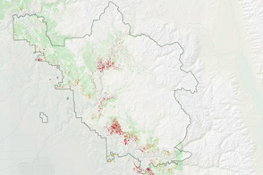
Mass tree die-offs in California’s Sierra Nevada mountains are sparking worries of fire in the region.
Published Jul 20, 2016
Differences in how international and national institutions classify forests can lead to large discrepancies in measurements of land cover.
Published Nov 17, 2015
Forests in drylands are much more extensive than previously reported.
Published Aug 10, 2017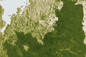
New analysis gives a clearer picture of changes to a forest landscape.
Published Mar 8, 2017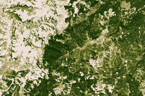
In some parts of Africa, trees are being grown instead of being cut down.
Published Mar 14, 2017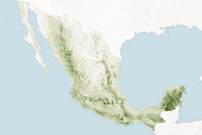
Mapping the density and location of tree cover can help the nation reduce deforestation and offset carbon emissions.
Published Nov 5, 2015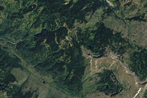
The 2012 U.S. Capitol Christmas tree — a 73-foot Engelmann spruce — hails from northwestern Colorado.
Published Dec 22, 2012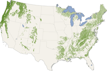
From the Pacific Northwest—home of the towering redwoods&mdash to the Southern Appalachians, this map shows forest canopy heights across the United States.
Published Jul 22, 2010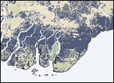
In early May 2008, Cyclone Nargis caused widespread flooding in Burma (Myanmar). Besides trying to assist the storm survivors, the international community also tried to determine the extent of flooding, but making such a determination can be difficult. Researchers at the University of Maryland’s Department of Geography developed a method of detecting floodwater by examining multiple sources of information to provide a better—though not perfect—picture of flooded areas.
Published May 16, 2008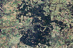
To celebrate Earth Day, Earth Observatory released a series of five puzzlers. Except for Thetford forest, all showed landscapes relatively untouched by human society.
Published Apr 27, 2013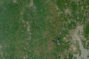
Dry weather in the Northeast has triggered an explosion in the populations of gypsy moth caterpillars, which are voracious eaters of forest canopies.
Published Jul 15, 2016
A three-dimensional view of an Alaskan forest is just one way scientists are tracking vegetation changes in the Tanana Valley.
Published Jul 27, 2016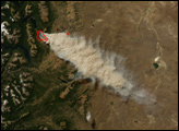
n the last week of February 2008, a forest fire broke out in the Alerces National Park in Argentina’s Patagonia region. Fanned by strong winds, the fire grew explosively in just a few hours. The blaze spread eastward and scorched more than 7,000 acres of woodland in the foothills of the Andres Mountains.
Published Mar 1, 2008
A small plane flying low over remote forests is sending back eye-popping aerial photography—as well as scientific measurements that will improve understanding of how Alaska’s forests are responding to global warming.
Published Jul 25, 2014
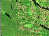
In British Columbia’s Coast Mountains, some 200 kilometers (125 miles) inland from the Pacific Ocean, rivers and lakes cut tortuous paths through rugged terrain. The peaks and valleys in this region are covered with forest, but the forest has changed over the years due to human use and insect pests, in particular, the mountain pine beetle.
Published Oct 12, 2008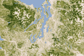
A new map of the biomass in the United States allows scientists and land managers to see tree cover down to the scale of individual plots of land.
Published Feb 17, 2012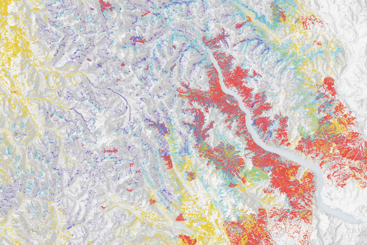
Wildfires make a significant mark on the bird’s nesting and roosting habitat.
Published Dec 23, 2019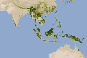
New maps show an estimate of the carbon stored in tropical forests and how sure scientists are about those estimates.
Published Jan 18, 2012