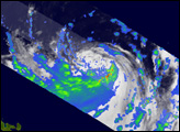
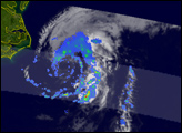
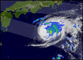
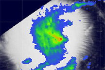
Rain rates in a few cloud bands on the eastern side of Typhoon Dolphin approached 50 millimeters per hour (red) when the storm was observed by the Tropical Rainfall Measuring Mission satellite on December 14, 2008.
Published Dec 16, 2008
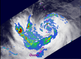
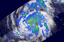
Cyclone Nargis passed over Burma (Myanmar) after having formed in the Bay of Bengal. At one point, Nargis was a Category 4 cyclone, with sustained winds of 210 kilometers per hour (130 miles per hour). The typhoon lost strength before coming ashore on May 2 as a Category 3/4 storm, but it still carried very powerful winds and heavy rain when it struck the low-lying coastal plains, causing severe damage. News reports cited a death toll of 10,000 people, with thousands more missing, as of May 5.
Published May 5, 2008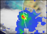
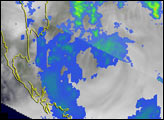
Acquired August 22, 2010, this image shows color-coded rainfall amounts superimposed on a photo-like image of Tropical Storm Danielle.
Published Aug 24, 2010