Water stretches across kilometers of land in Namibia's Caprivi strip in this Terra MODIS image from April 14, 2009.
Published Apr 16, 2009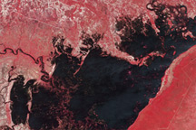
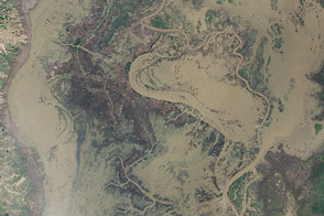
This pair of images from the Advanced Spaceborne Thermal Emission and Reflection Radiometer (ASTER) on NASA’s Terra satellite shows flooding in along the Chobe River in Namibia.
Published Apr 8, 2009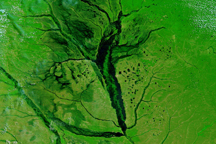
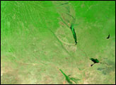
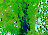
Rivers throughout the western portion of southern Africa were visibly flooded on March 25, 2009, when this image was captured.
Published Mar 25, 2009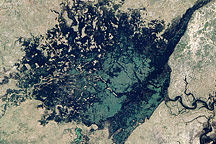
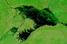
Water flowed from the flooded Zambezi River into the wetland in northern Namibia shown in this image.
Published Apr 20, 2009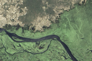
Flowing down a gentle gradient, the river often spills onto floodplains during the rainy season.
Published Apr 6, 2013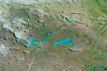
Acquired February 13, 2011, and February 19, 2010, these false-color images show part of South Africa before and after unusually heavy rains in the 2011 rainy season.
Published Feb 14, 2011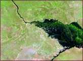
Heavy rains in southern Africa caused severe flooding along the Shire River in January 2015.
Published Jan 29, 2015