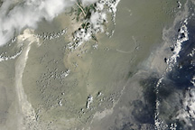
Beneath scattered clouds, streaks and ribbons of oil brightened the reflection of the Sun off the Gulf of Mexico in this photo-like satellite image from May 31, 2010.
Published Jun 1, 2010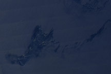
This image from the Moderate Resolution Imaging Spectroradiometer (MODIS) on NASA’s Aqua satellite on August 30, 2009, shows the Timor Sea and what are probably oil slicks about 250 kilometers northwest of Western Australia.
Published Sep 2, 2009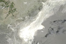
Acquired June 25, 2010, this natural-color image shows the oil slick in the Gulf of Mexico.
Published Jun 26, 2010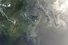
In this photo-like satellite image from June 12, 2010, oil from the leaking Deepwater Horizon well appears to have reached beaches and barrier islands in Alabama and western Florida.
Published Jun 14, 2010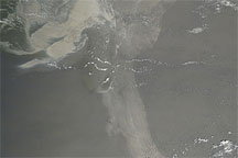
Acquired May 17, 2010, this natural-color image shows the oil slick in the Gulf of Mexico extending a long arm toward the southeast.
Published May 19, 2010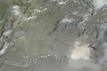
Acquired July 11, 2010, this natural-color image shows an apparent oil slick southeast of the Mississippi Delta.
Published Jul 11, 2010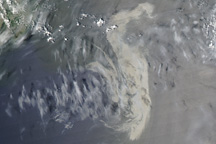
A large, silvery patch of oil is visible in this image of the Gulf of Mexico from May 11, 2010.
Published May 11, 2010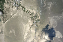
The oil spill in the Gulf of Mexico appeared large and sprawling in this natural-color image from May 25, 2010.
Published May 26, 2010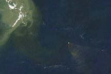
On April 21, 2010, brownish smoke fanned out to the southeast of a burning oil rig in the Gulf of Mexico.
Published Apr 22, 2010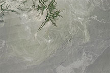
Acquired in the months after the Deepwater Horizon oil spill, this natural-color image shows possible oil patches near the Mississippi Delta.
Published Jul 30, 2010