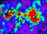
The first image released from the Gravity Recovery and Climate Experiment (GRACE), a joint NASA-German Aerospace Center mission, graphically illustrates the sensitivity of the mission’s twin spacecraft to changes in Earth’s gravity
Published Dec 11, 2002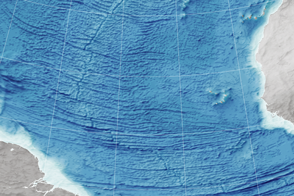
Scientists read the bumps on the ocean surface to understand the shape of the seafloor below.
Published Dec 29, 2015
Middle school students took this picture of our planet from the far side of the Moon in mid-March 2012.
Published Apr 8, 2012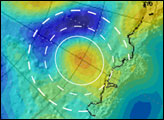
In June 2006, researchers at Ohio State University announced that GRACE had found a mass concentration under the ice in East Antarctica.
Published Aug 23, 2006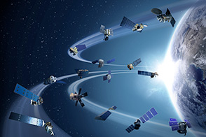
Sixteen operating satellites monitor Earth. Four more are scheduled to launch in 2014.
Published Jul 5, 2013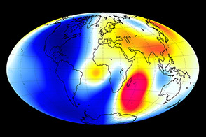
A new constellation of satellites from the European Space Agency can detect minuscule changes in the planet’s magnetic field.
Published Sep 7, 2014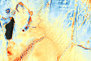
The recent discovery of the Mammerickx Microplate was made possible by new satellite-derived maps of the ocean floor.
Published Jan 13, 2016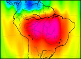
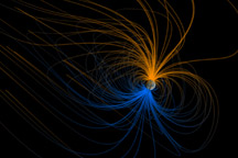
Earth is a great magnet, and scientists have spent a century exploring its shape and structure. This visualization shows the magnetic field around Earth, or magnetosphere.
Published Apr 23, 2011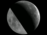
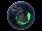
From space, the aurora is a crown of light that circles each of Earth’s poles. The IMAGE satellite captured this view of the aurora australis four days after a record-setting solar flare sent plasma flying towards the Earth.
Published Jan 25, 2006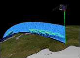
Orbiting the Earth at nearly 17,000 miles per hour, NASA's Ice, Cloud and land Elevation Satellite (ICESat) is collecting spectacular new three-dimensional measurements of the Earth's surface and atmosphere.
Published Dec 10, 2003
This image of Earth was captured by the MESSENGER spacecraft during a flyby of our home planet on August 2, 2005. Parts of South and North America were in view.
Published May 8, 2009