Chinese engineers changed the main channel through the delta, changing the shape of the land at the river’s mouth.
Published Jan 27, 2010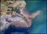
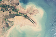
The Yellow River Delta coastline along the Gulf of Bohai has always experienced dramatic changes, and those changes continue today. This mosaic of images taken by astronauts aboard the International Space Station shows several things. First, the image shows today’s configuration of the delta of China’s Yellow River, which is one of the most dynamic coastlines on Earth. Second, the scene allows mapping of land use along the coastal plain, including the boundaries of the Shengli Oil Field, China’s second largest oil field. But perhaps the most interesting aspect of this image is the large patch of green water off the northern coast of the delta—a presumed plankton bloom.
Published Aug 23, 2004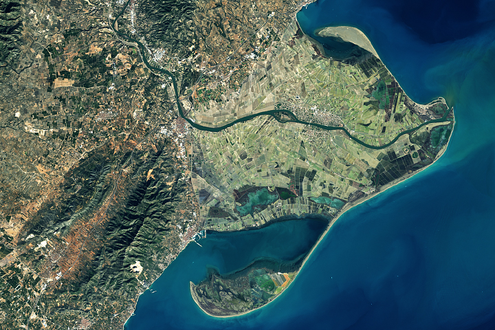
Spain's Ebro Delta has recently experienced tremendous shape-shifting.
Published Mar 13, 2018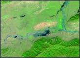
Relentless rains are to blame for ongoing flooding in northeastern China. On September 1, 2003, embankments along the Weihe river, left, burst.
Published Oct 23, 2003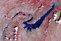
This false-color image shows the central part of the Vakhsh River, including the Nurek Dam and reservoir.
Published Nov 25, 2008
In the past few centuries, a river in northwestern Canada stopped wandering and assumed a more direct route to the sea.
Published Sep 4, 2012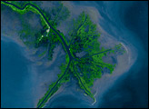
Time, weather, and human intervention have all shaped the Mississippi Delta in Louisiana, a giant bird’s foot shape protruding into the Gulf of Mexico. The Mississippi River deposits sediment into the ocean, and over 25 years, NASA Landsat satellites observed changes in the delta’s shape.
Published Oct 7, 2007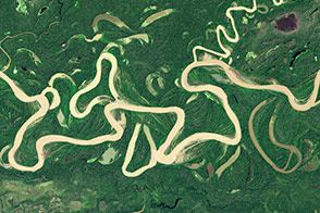
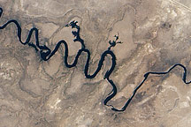
Lowland rivers that carry large volumes of sediment are on the move.
Published Dec 4, 2014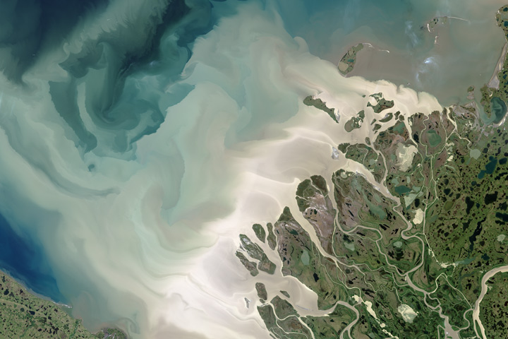
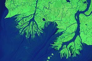
Canada’s largest and longest river delivers vast amounts of fresh water and sediment to the sea.
Published Aug 6, 2017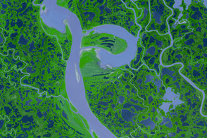
Canada’s Mackenzie River, the country’s longest, spills out of Great Slave Lake, just north of the border between Alberta and Northwest Territories.
Published Dec 20, 2007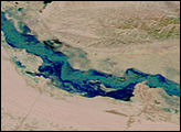
While most of the Mississippi River’s delta plain is losing ground, new land is forming at the mouths of the Wax Lake Outlet and the Atchafalaya River.
Published Feb 12, 2015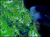
In September 2010, water again flowed through this riverbed after several dry years.
Published Oct 8, 2010