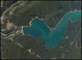
Chile’s Bíobío River flows northwestward from the high Cordillera of the Andes to the Pacific Ocean near Concepción, about 450 kilometers south of Santiago. The river is known globally for spectacular white-water rafting. This image shows a section of the river that skirts around Callaqui volcano in the Andes, and features the Pangue Dam and reservoir filling a narrow, meandering segment of the Bíobío River valley. Completed in 1996, the dam is the first of six hydroelectric dams planned by ENDESA, a Chilean utility company. The future development of the Bíobío River is a point of intense debate among Chileans, and has been called Chile’s “defining environmental issue.”
Published Feb 16, 2004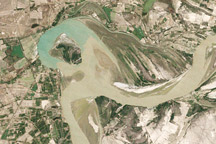
Between 1992 and 2009, a section of the lower Indus River changes course following the formation of an oxbow lake.
Published May 9, 2010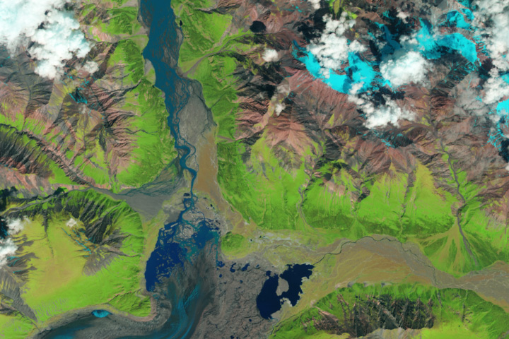
The Kaskawulsh River stole most of the water from the Slims River, dramatically reshaping the region’s drainage.
Published Apr 28, 2017
Floods and new infrastructure have long since separated the distinctive bend in the river that was portrayed by landscape painter Thomas Cole in 1836.
Published Oct 15, 2017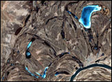
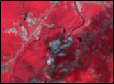
This false-color image from April 1, 2002, shows numerous braided channels and oxbow lakes along the Songhua River in northeastern China, just upstream of the city of Harbin.
Published Dec 27, 2005
Trees have long been cherished here for timber and for the colors they bring to “the Fall Rhapsody.”
Published Oct 24, 2020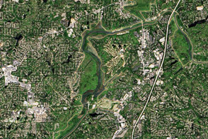
The river supplies Atlanta with its drinking water and a bit of recreational fun.
Published Nov 13, 2016
A satellite image offers inky evidence of the organic-rich freshwater that the Suwannee River delivers to the Gulf of Mexico.
Published Oct 27, 2018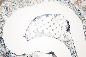
The meandering Missouri River doubled back on itself and formed this U-shaped lake.
Published Jan 13, 2014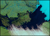
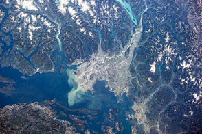
British Columbia's longest river delivers sediment and nutrients to the Strait of Georgia.
Published Jan 7, 2015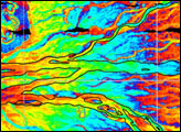
This model of the land elevation between the Mississippi, the Atchafalaya, and the Old River show the uphill fight to control river flow.
Published Jun 4, 2011
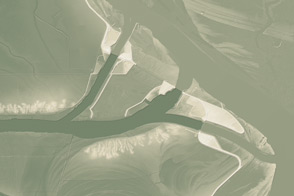
Acquired May 1, 2011, this natural-color image shows the James River completely filling the river valley near Jamesville, South Dakota.
Published May 3, 2011