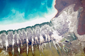
Unusual stream patterns in Western Australia seem to have origins inland and in the past.
Published Feb 15, 2016
Linear dunes and ephemeral streams converge on the eastern margin of the Simpson Desert in a region known for its floods.
Published Sep 15, 2012
Linear dunes dominate the landscape of eastern Namibia. Part of the Kalahari Desert, the dunes likely formed more than 10,000 years ago.
Published Dec 4, 2011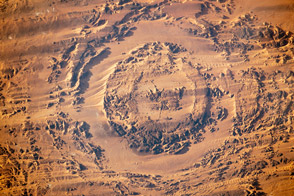
Photographs taken by astronauts on the ISS in 2003 and 2013 show the evolution of a dune field in Chad.
Published Dec 9, 2013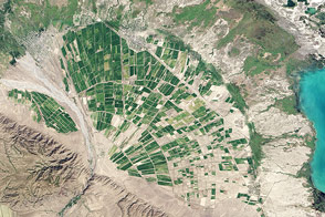
When streams emerge from mountains, they often spread out and deposit sediment in a distinctive pattern known as an alluvial fan.
Published Apr 8, 2014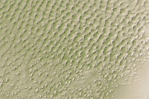
This digital elevation map of the Badain Jaran Desert shows multi-generation dunes, with smaller dunes resting atop larger ones.
Published Apr 20, 2011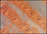
One of the main reasons that rainless regions like the Sahara Desert are interesting from the perspective of landscape science is that the work of flowing water—mainly streams and rivers—becomes less important than the work of wind. Over millennia, if enough sand is available, winds can generate dunes of enormous size, arranged in regular patterns. Long, linear dunes stretch generally north to south across much of northeast Algeria, covering a vast tract (~140,000 square kilometers) of the Sahara Desert known as the Erg Oriental. Erg means “dune sea” in Arabic, and the term has been adopted by modern geologists. Spanning this image from a point on the southwest margin of the erg (image center point: 28.9°N 4.8°W) are a series of 2-kilometer-wide linear dunes, comprised of red sand. The dune chains are more than 100 meters high. The “streets” between the dunes are grayer areas free of sand.
Published Sep 11, 2006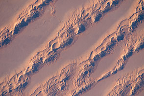
Large linear dunes stretch across the Great Eastern Sand Sea of northern Algeria.
Published Apr 4, 2016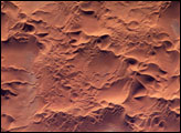
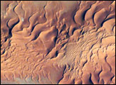
he Issaouane Erg (sand sea) is located in eastern Algeria between the Tinrhert Plateau to the north and the Fadnoun Plateau to the south. Considered to be part of the Sahara Desert, the Issaouane Erg covers an area of approximately 38,000 km2. These complex dunes form the active southwestern border of the sand sea.
Published Feb 7, 2005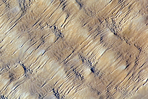
Layers of dunes march across a sand sea in the east-central Tenéré Desert of Niger in this astronaut photo from December 1, 2009.
Published Dec 28, 2009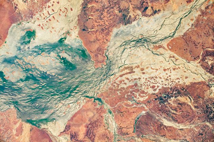
The combination of stable, ancient dunes and water channels displaying both braided and cross-connecting patterns make this region a planetary analogue for Mars.
Published Aug 2, 2020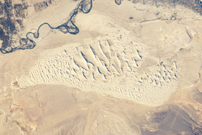
This photograph taken by an astronaut on the International Space Station highlights a sand dune field within the Burqin-Haba River-Jimunai Desert near the borders of China, Mongolia, Russia, and Kazakhstan.
Published Sep 19, 2011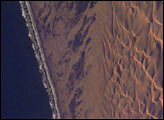
This detailed view of the remote Conception Bay sector of the Namibian coastline shows breakers and a strand plain on the left and complex dunes of the Namib dune sea on the right. A strand plain is a series of dunes, usually associated with and parallel to a beach, sometimes containing small creeks or lakes. The complexity and regularity of dune patterns in the dune sea of the Namib Desert have attracted the attention of geologists for decades; however, they remain poorly understood. The flat strand plain (roughly 4 kilometers shown here) shows a series of wet zones that appear black where seawater seeps inland and evaporates. These patches are aligned with the persistent southerly winds, some of the strongest of any coastal desert.
Published Oct 3, 2005