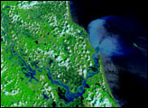
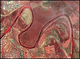
Acquired July 11, 2010, and June 21, 2010, these false-color images show northeastern Mexico before and after flooding along the Rio Salado.
Published Jul 15, 2010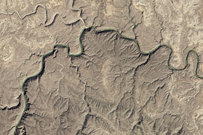
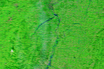
The eastern section of the Rio Grande Wild and Scenic River runs deep through the desert wilderness.
Published Jun 11, 2016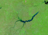
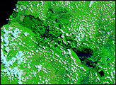
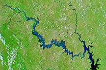
Intense rain swelled rivers in east-central France on November 2 and November 3, 2008, forcing hundreds of evacuations and closing two major highways.
Published Nov 3, 2008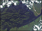
The wide, multi-island zone in the Rio Negro (Black River) shown in this astronaut photograph from September 2, 2006, is one of two, long “archipelagoes” upstream of the city of Manaus (not shown) in central Amazonia. Sixty kilometers of the total 120-kilemeter length of this archipelago appear in this image.
Published Dec 4, 2006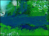
India’s Brahmaputra River was already flooded in early August, but those floods turned out to be small compared to the floods that hit the river in early September. The river flooded for the third time in 2007 when monsoon rain pounded northeastern India, Bhutan, and Bangladesh in September.
Published Sep 14, 2007