An ambitious project in South San Francisco Bay is designed to restore wetlands and marshes, as well as the species that go with them.
Published Feb 11, 2016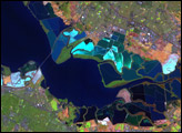
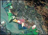
Astronauts aboard the International Space Station (ISS) took this photograph of the San Francisco Bay area in April, 2002. The gray urban footprint of San Francisco, Oakland, San Jose, and their surrounding suburbs contrast strongly with the green hillsides. Of particular note are the Pacific Ocean water patterns that are highlighted in the sun glint. Sets of internal waves traveling east impinge on the coastline south of San Francisco. At the same time, fresher bay water flows out from the bay beneath the Golden Gate Bridge, creating a large plume traveling westward. Tidal current channels suggest the tidal flow deep in thebay. Because the ISS orbits are not synchronous with the sun, astronauts view the Earth with variable solar illumination angles. This allows them to document phenomena such as the sun reflecting differentially off surface waters in a way that outlines complicated water structures.
Published May 26, 2002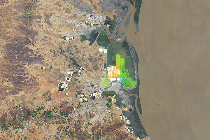
The west-central state of Gujarat accounts for nearly three-quarters of India’s annual salt production.
Published Oct 21, 2019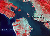

Colorful, mineral-rich salt flats are nestled between the Promontory Mountains and the Great Salt Lake.
Published Oct 4, 2020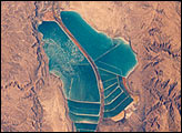
The complex of Jordanian salt evaporation ponds at the southern end of the Dead Sea has expanded significantly over the past dozen years. The western margin of the salt ponds marks the Jordan-Israel border. In August 1989, when the crew of Space Shuttle mission STS-28 photographed the region, the northern extension did not exist and the large polygonal ponds in the northwestern and northeastern sectors had not been subdivided. In the view taken by the STS-102 crew in March 2001, one can see that there has also been expansion at the southeastern end, and that levees now segment the northeastern wedge into four ponds.
Published May 13, 2001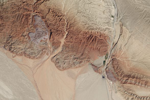
In this active tectonic environment, salt squeezes through faults in the rock until it reaches the surface and flows like a glacier.
Published Oct 25, 2015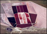
This detailed astronaut photograph shows the salt ponds of one of Africa’s major producers of soda ash (sodium carbonate) and salt. Soda ash is used for making glass, in metallurgy, in the detergent industry, and in chemical manufacture. The image shows a small part of the great salt flats of central Botswana known as the Makgadikgadi Salt Pans.
Published May 13, 2007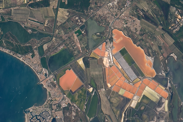
The salt produced from tidal marshes in southern France is the product of ideal climate conditions and careful management.
Published Apr 4, 2019
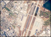
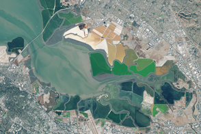
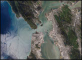
This astronaut photograph illustrates the diverse built environment surrounding the NASA Ames Research Center located at the southernmost end of San Francisco Bay. Founded in 1939 as an aircraft research laboratory, Ames became a NASA facility in 1958. Its original aircraft research focus was enhanced by the adjacent Moffett Field—an active Naval Air Station until 1994, and the original home of the Navy dirigible U.S.S. Macon. The large hanger for docking the U.S.S. Macon is still present at Moffett Field, and is visible in this astronaut photograph (image center). Today, NASA Ames includes the former Naval Air Station, and it continues its focus on aeronautics in addition to nanotechnology, information technology, fundamental space biology, biotechnology, thermal protection systems, and human factors research.
Published Jun 9, 2008
Southeastern Iran is home to numerous salt domes and salt glaciers, which have been built over time by the movement of Earth’s crust.
Published Nov 13, 2017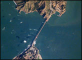
The Golden Gate of San Francisco Bay is one of the most recognizable straits in the world due to the Golden Gate Bridge that spans it. This high-resolution astronaut photograph is a nearly cloud-free view of the northern part of the San Francisco metropolitan area.
Published Sep 4, 2006