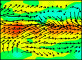
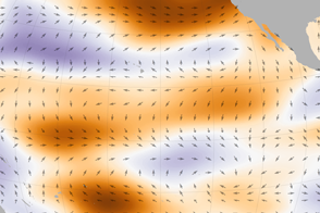
A NASA scatterometer observes how winds shifted over the Pacific Ocean during one of the strongest El Niños on record.
Published Mar 3, 2016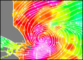
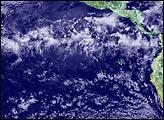
Storms like Typhoon Vamei are not supposed to happen.
Published May 9, 2003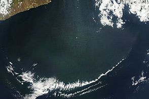
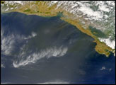
Unusually strong winds pushed through Mexico’s Chivela Pass and carried dust over the Gulf of Tehuantepec.
Published Apr 13, 2014
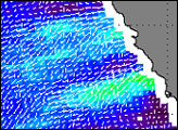
A strip of cold water hugging the equator in the eastern tropical Pacific Ocean in mid-June may foreshadow a transition from El Niño to La Niña conditions
Published Jun 24, 2010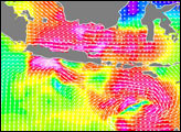
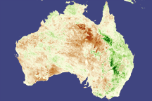
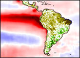
La Niña’s fingerprint is all over plants in eastern Australia and southern Africa in this pair of vegetation images from the SPOT satellite.
Published Mar 15, 2008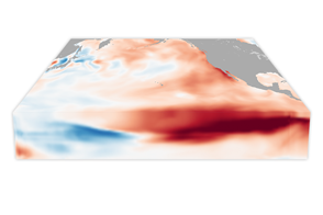
With its own forms of underwater weather, the ocean has fronts and circulation patterns that move heat and nutrients around its basins. Changes near the surface often start with changes in the depths.
Published Mar 21, 2017