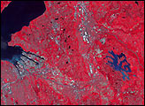
A deadly magnitude 6.1 earthquake struck Bhutan on September 21, 2009.
Published Sep 21, 2009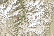
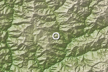
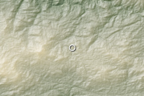
The mountainous topography of southern China reveals something of the tectonic forces that generate strong earthquakes such as one that occurred on July 9, 2009.
Published Jul 11, 2009
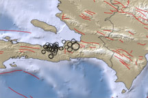
This map shows the region around the earthquake that struck the Haitian capital of Port-au-Prince on January 12, 2010. Blue areas indicate water and brown areas indicate land. Lighter colors indicate higher elevation or shallower depth. Circles indicate earthquake locations, with circle size corresponding to earthquake magnitude. Lines indicate faults.
Published Jan 13, 2010
A strong earthquake struck southern Mexico on March 20, 2012, near the converging Cocos and North American tectonic plates.
Published Mar 20, 2012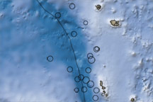
This map shows the region surrounding the earthquakes that occurred near Vanuatu on October 7 and 8, 2009. Ocean water appears in shades of blue, and land areas appear in shades of brown. Circles mark earthquake locations, and a black line marks the tectonic plate boundary.
Published Oct 9, 2009