Ice loss in Patagonia has struck more than just the largest and most frequently studied ice fields.
Published Feb 23, 2016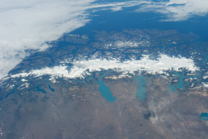
Straddling the southern Andes Mountains in Chile and Argentina, these glaciers have thinned significantly in the past four decades.
Published Mar 3, 2014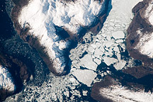
This astronaut photograph shows the merged outlet of two glaciers within the deep fjords of the Southern Patagonian Ice Field.
Published Oct 5, 2009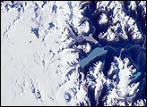
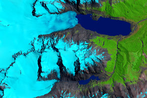
The Northern Patagonian Ice Field (NPIF), centered near 47°S, 73.5°W, is the smaller of two remnant ice masses crowning the Andes Mountains of lower South America. The NPIF is a vestige of an extensive ice sheet that covered much of Patagonia just over a million years ago. Today, with its glaciers largely in retreat and only an area of 4,200 sq km, it is still the largest continuous mass of ice outside of the polar regions.
Published Feb 2, 2002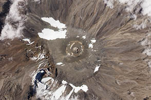
A recent expedition revealed a new rift in Kilimanjaro’s northern ice field.
Published Nov 8, 2012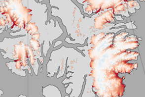
These color-coded maps show ice mass changes in the northern Canadian Arctic Archipelago from 2004 to 2009.
Published Jun 1, 2011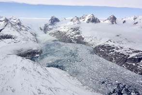
NASA aircraft return to the Arctic to assess the health of the region’s ice.
Published May 3, 2012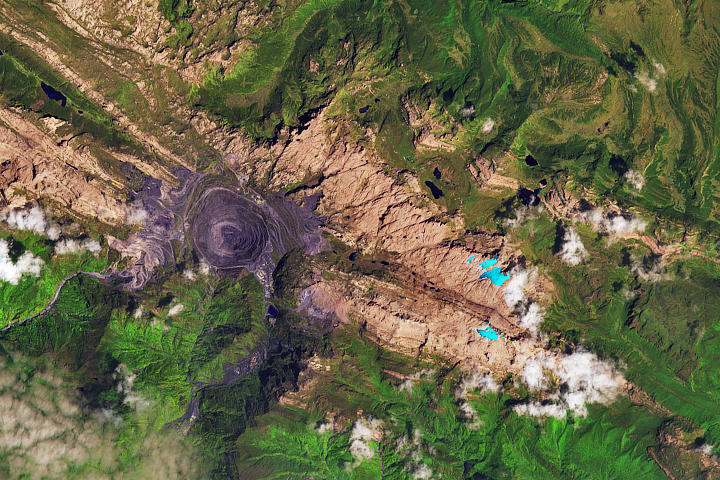
Though the mountains are located just south of the equator, their elevation is high enough and the air temperatures are cold enough to still support a few small areas of ice.
Published Feb 14, 2018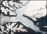
Brüggen Glacier in southern Chile is the largest western outflow from the Southern Patagonian Ice Field and, unlike most glaciers worldwide, advanced significantly since 1945. From 1945 to 1976, Brüggen surged 5 km across the Eyre Fjord, reaching the western shore by 1962 and cutting off Lake Greve from the sea.
Published Dec 9, 2001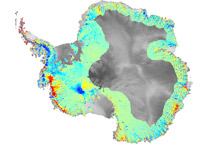
To understand how fast-moving glaciers are changing the ice sheets, scientists devised a method to map elevation change using data from ICESat.
Published Oct 3, 2009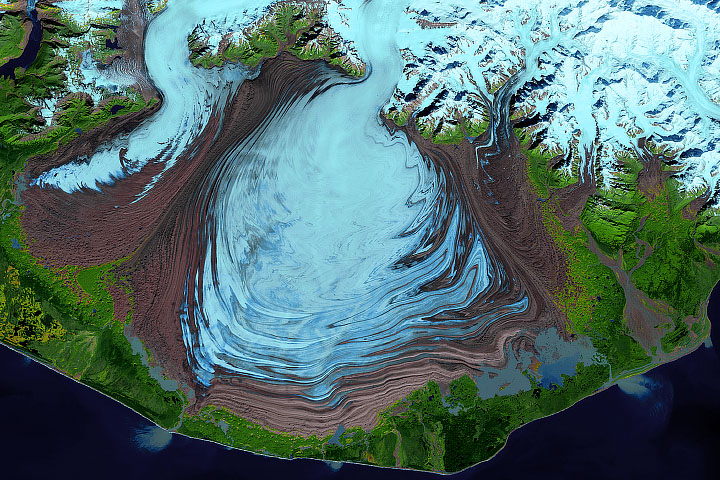
More than 30 years of ice velocity data are helping scientists tease out how mountain glaciers respond to climate change.
Published Sep 11, 2019
Located in East Antarctica, Astrolabe Glacier streams out from the interior of Antarctica to dump ice into the sea.
Published Mar 26, 2011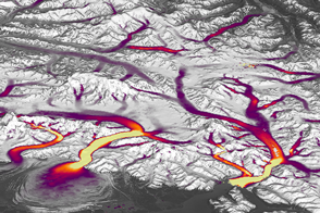
Better Landsat imaging and creative use of software is allowing scientists to map details of changing glaciers and ice sheets.
Published Dec 14, 2016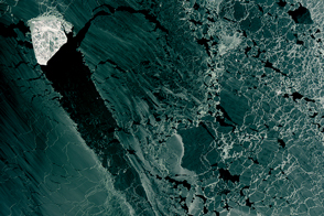
A diamond-shaped piece of ice is a stranger amid thin ice.
Published Mar 1, 2017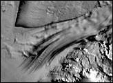
A slab of ice larger than the continental United States smothers much of East Antarctica. Draining from the East Antarctic Ice Sheet is a river of ice nearly 800 kilometers long. This stream, the Recovery Ice Stream, slides roughly 35 billion tons of ice into the ocean each year.
Published Apr 26, 2007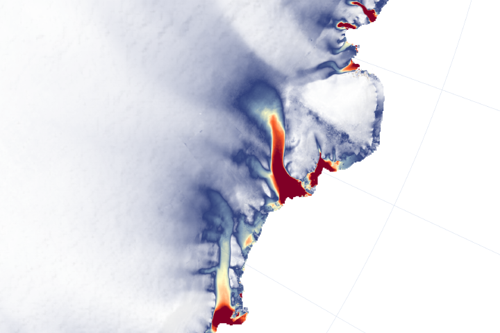
Satellites detect changes in the height and velocity of ice in an area that was thought to be relatively stable and quiet.
Published Dec 11, 2018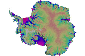
Scientists mapped the motion of Antarctica’s ice sheets and revealed unexpected patterns.
Published Aug 19, 2011