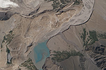
Acquired July 7, 2010, and August 23, 2010, these natural-color images show slight changes in a landslide lake along the Hunza River in northwestern Pakistan.
Published Aug 29, 2010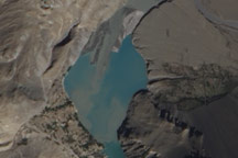
Acquired October 3, 2010, this natural-color images show slight changes in a landslide lake along the Hunza River in northwestern Pakistan.
Published Oct 13, 2010
Ongoing drought and diminished snowpack in the Rockies have combined with increasing demands downstream to cause the great reservoir to drop to historically low levels.
Published Aug 1, 2014
In August 2010, Lake Mead reached its lowest level since 1956, the result of a persistent drought and increasing human demand.
Published Sep 23, 2010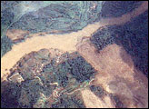
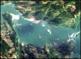
In the wake of the May 12, 2008, earthquake in China, a series of landslides blocked the Jiangjiang River, creating swollen reservoirs that threatened to break through and flood catastrophically. The largest of these lakes, Tangjiashan Lake, threatened roughly 1.3 million people.
Published Jun 11, 2008
In May 2016, the reservoir behind Hoover Dam reached its lowest level since the 1930s.
Published May 27, 2016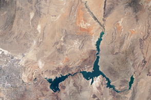
The water within a large, key reservoir in the southwestern United States has fallen to levels not seen since the 1930s.
Published Aug 18, 2015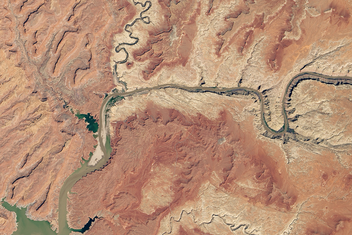
Heavy winter and spring snowfall provided much-needed meltwater, but the effects of long-term drought mean the lake is nowhere near its highs from the 1980s and 90s.
Published Oct 1, 2019
Surging with fresh water from heavy winter snow melt, Lake Powell rose significantly in the summer of 2011 after many years of low levels.
Published Aug 12, 2011
Acquired on August 11, 1984 (top), and September 1, 2009 (bottom), these true-color images show dramatic expansion of Devils Lake in North Dakota. In the 1990s, the lake began flooding, spilling into neighboring Stump Lake.
Published Feb 14, 2010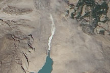
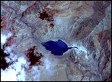
Acquired July 7, 2010, this photo-like image shows water from a landslide-dammed river flowing through a human-made spillway in northwestern Pakistan’s Hunza Valley.
Published Jul 8, 2010