An astronaut captured this photo of the historic stretch of southern coastline of Oahu.
Published Dec 7, 2009
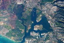
Located on the highly populated Hawaiian island of Oahu just west of Honolulu, Pearl Harbor is the historic center of events on “the day that will live in infamy”—December 7, 1941—when the Japanese fleet launched a surprise air attack on Pearl Harbor and other strategic military targets on Oahu. The ISS-6 Space Station crew obtained this high-resolution image of Pearl Harbor in March 2003, enabling detailed observations of the harbor and its multiple uses.
Published Jul 12, 2004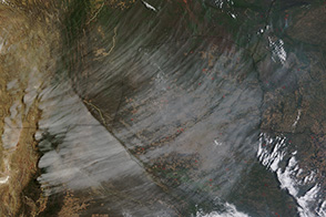
Strong winds and the Andes Mountains clashed, resulting in a rare view of a bank of high cirrus clouds over South America.
Published Nov 3, 2013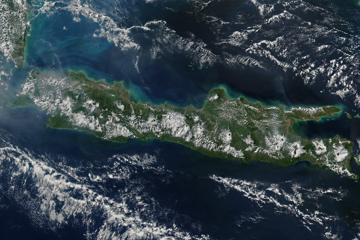
By the afternoon, clouds ring the volcanoes on the Indonesian island of Java.
Published May 28, 2017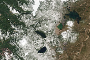
The Cascade Mountains and nearby forests and lakes provide a good test of the visual range of the new LDCM satellite.
Published Apr 30, 2013

As winds streamed past the South Sandwich Islands, the disrupted flow created an interlocking series of wave clouds.
Published Feb 28, 2020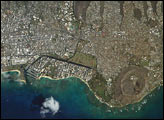
As the Expedition 7 crew on the International Space Station was set to come home to Earth, crew member Ed Lu was inspired to photograph his hometown, Honolulu, during an overpass. Honolulu is striking for the way it is bound by surrounding geography. Built-up fingers of the city extend northeast onto the steep volcanic slopes and surround the volcanic craters of Punchbowl and Diamond Head, leaving undeveloped only parklands and the steepest ridges. They are both tuff cones that formed as magma from the erupting volcano came in contact with ground water at a time when sea levels were higher than they are now. As the water turned to steam, it caused an explosion that formed a hill of ash with a broad crater in the center.
Published Oct 27, 2003
Acquired April 29, 2011, this natural-color image shows wakes created by the Juan Fernandez Islands off the coast of Chile.
Published May 31, 2011
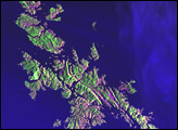
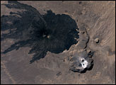
The Tibesti Mountain Range in northern Chad is one of the world’s least-studied volcanic regions. A look at the area from space, however, must intrigue vulcanologists. One of the Tibesti Mountain’s features is Tarso Toussidé.
Published Mar 18, 2007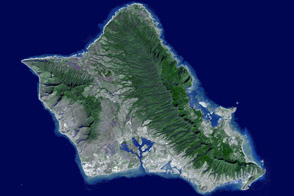
This fly-over tour of O’ahu, Hawaii highlights the island’s steep mountains, unique coastline, and volcanic features.
Published Oct 30, 2011