This photo-like image paints a picture of the movement of air and weather over the Ural Mountains in southern Russia, with the western mountains covered with snow and the eastern plain dry. The image also illustrates the influence of the mountains on cloud formations.
Published Nov 21, 2008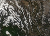
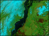
Images acquired by the Moderate-resolution Imaging Spectroradiometer (MODIS) on NASA's Terra satellite show the spring thaw and resulting flooding of the Lena River, a principal waterway of eastern Siberia.
Published May 31, 2001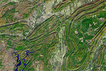
Acquired November 13, 2002, this false-color image shows part of the Ouachita Mountains in southeastern Oklahoma.
Published Oct 24, 2010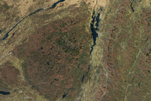
The red and orange tones of autumn had faded to brown in the mountains of New York and Vermont when this true color image was taken on November 8, 2009. The contrast between the green and gold valleys and brown mountains help reveal the unique geography of the region.
Published Nov 14, 2009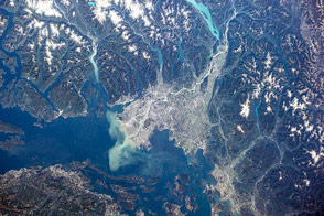
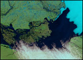
British Columbia's longest river delivers sediment and nutrients to the Strait of Georgia.
Published Jan 7, 2015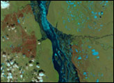
In the span of three weeks, spring crept over the Siberian landscape surrounding the northern half of the Lena River. Many of the rivers in Earth’s temperate zones run high in the spring when melting snow and spring rain flood river basins. On the Lena River, however, spring flooding is almost inevitable for another reason: ice. Like other north-flowing rivers, the upper reaches of the Lena melt before their downstream counterparts. Because the northern mouth of the river remains frozen while the southern body of the river flows freely, water naturally builds behind the ice, forming a temporary reservoir that drains as the ice dwindles.
Published Jun 2, 2007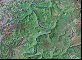
Alaska gradually thawed over the month of May as spring’s warmth crept north. The melting snow and thawing ice filled the Yukon River until it bulged over its banks with runoff.
Published Jun 9, 2006