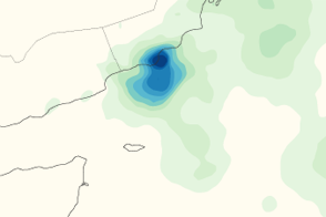
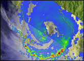
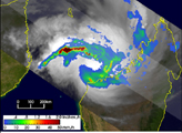
This color-coded map shows rainfall amounts associated with Tropical Storm Keila. The most intense rain occurs along the coast of Oman.
Published Nov 8, 2011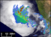
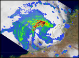
Cyclone Nargis passed over Burma (Myanmar) after having formed in the Bay of Bengal. At one point, Nargis was a Category 4 cyclone, with sustained winds of 210 kilometers per hour (130 miles per hour). The typhoon lost strength before coming ashore on May 2 as a Category 3/4 storm, but it still carried very powerful winds and heavy rain when it struck the low-lying coastal plains, causing severe damage. News reports cited a death toll of 10,000 people, with thousands more missing, as of May 5.
Published May 5, 2008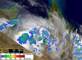
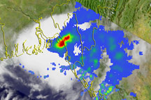
This image shows the rainfall associated with Tropical Cyclone Bijli as observed by the TRMM satellite.
Published Apr 20, 2009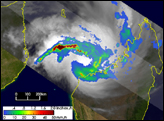
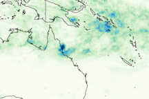
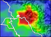
This image shows rainfall totals for January 27 through February 3, 2009, for northeastern Australia and the surrounding region, where Cyclone Ellie made landfall on February 2.
Published Feb 4, 2009