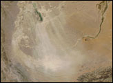
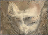
Straddling the borders of Iran, Pakistan, and Afghanistan, the Hamoun Wetlands had long been an oasis in the otherwise arid landscape of Central Asia. By the turn of the twenty-first century, however, these wetlands were desiccated by irrigation and drought. In mid-May 2008, a dust storm arose from dry lake beds left behind by the once-moist wetlands.
Published May 19, 2008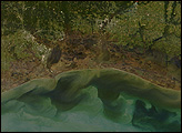
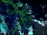
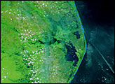
This photo-like image of the Texas and Louisiana coasts shows the impact of Hurricane Ike’s powerful storm surge on coastal wetlands. Hurricane Ike came ashore bringing with it a wall of water that stretched from Galveston, Texas, across all of coastal Louisiana.
Published Oct 4, 2008
Ten years after the storm made landfall, a record of Katrina’s fury remains in the marshes surrounding Delacroix.
Published Aug 28, 2015