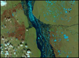
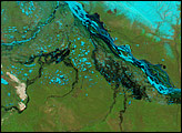
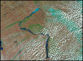
In the span of three weeks, spring crept over the Siberian landscape surrounding the northern half of the Lena River. Many of the rivers in Earth’s temperate zones run high in the spring when melting snow and spring rain flood river basins. On the Lena River, however, spring flooding is almost inevitable for another reason: ice. Like other north-flowing rivers, the upper reaches of the Lena melt before their downstream counterparts. Because the northern mouth of the river remains frozen while the southern body of the river flows freely, water naturally builds behind the ice, forming a temporary reservoir that drains as the ice dwindles.
Published Jun 2, 2007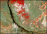
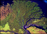
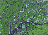
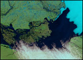
The Lena River fractures into myriad streams that fan out across the tundra and empty into the Arctic Ocean. During the short summer, it thaws into a wetland of tremendous ecological importance.
Published Jan 25, 2007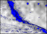
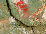
Springtime flooding in southern Siberia is not unusual. Melting snow fills the north-flowing rivers in the south even as upstream sections of the river are still frozen. Floods build up behind dams of ice, or simply build under the fast flow of spring runoff. Spring of 2006 was not exceptional.
Published May 8, 2006