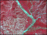
Acquired June 27, 2011, and May 28, 2011, these false-color images compare conditions along the Yangtze River before and after torrential rains.
Published Jun 28, 2011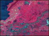
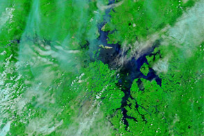
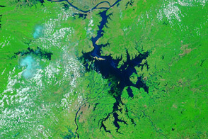
Acquired June 23, 2011, and May 26, 2011, these false-color images show changes in Dongting and Poyang Lakes, comparing drought to flood conditions.
Published Jun 23, 2011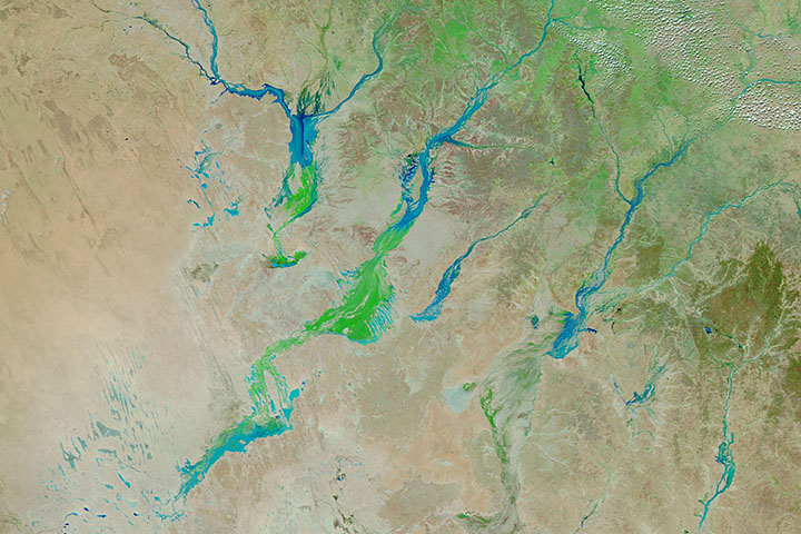
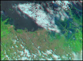
Big rain events in Queensland can alter the landscape for months as water—and then a carpet of vegetation—moves toward Lake Eyre.
Published Apr 3, 2019
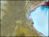
This pair of images from the Advanced Spaceborne Thermal Emission and Reflection Radiometer (ASTER) on NASA’ Terra satellite shows wide-spread flooding in Oshakati, Namibia, on March 28, 2009.
Published Apr 1, 2009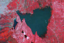
In September 2004, more than 2,500 people died when Tropical Storm Jeanne unleashed torrential rain on northeastern Haiti, triggering devastating floods and mudslides in Gonaïves. The disaster was repeated in September 2008, when a string of storms—Gustav, Hanna, and Ike—drenched Haiti.
Published Sep 24, 2008