The Arctic Ocean is largely hemmed in by the northern edges of Eurasia and North America. As a result, pieces of drifting pack ice have few outlets for escape when sea ice is thinning and breaking up in the spring and summer.
The primary passageway out of the Arctic is the Fram Strait between Greenland and Svalbard. However, a narrower waterway to the west—the Nares Strait, which separates Greenland and Ellesmere Island—is also important. Scientists keep an eye on Nares because a southward flowing current, fueled by the Beaufort Gyre, sends a significant amount of ice through it each summer and fall.
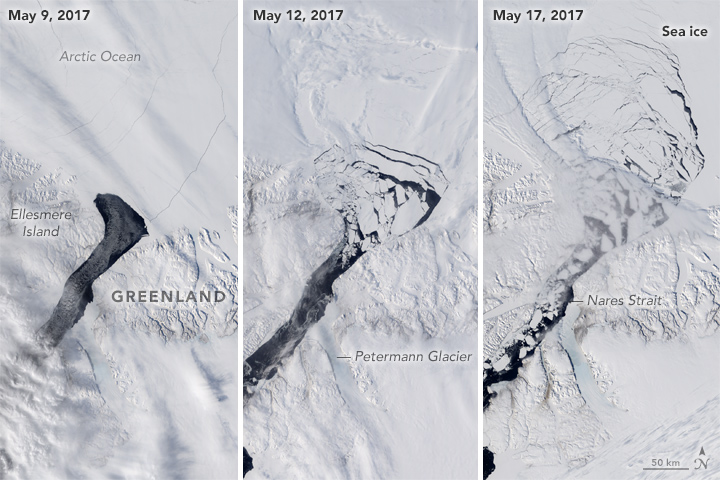
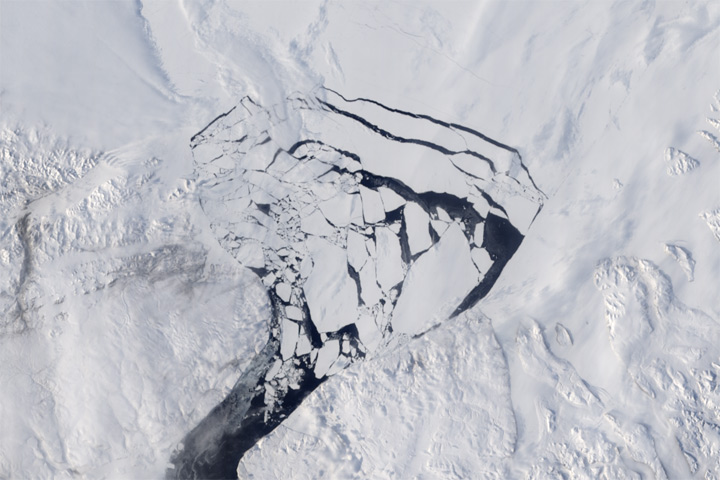
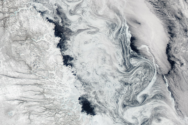
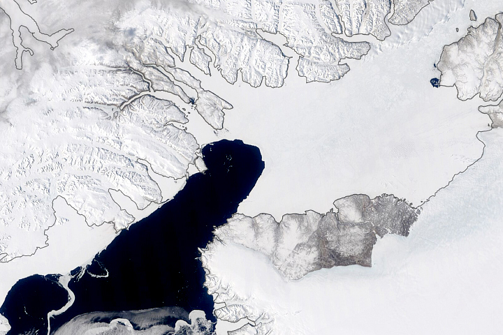
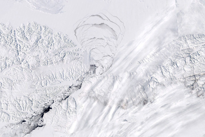
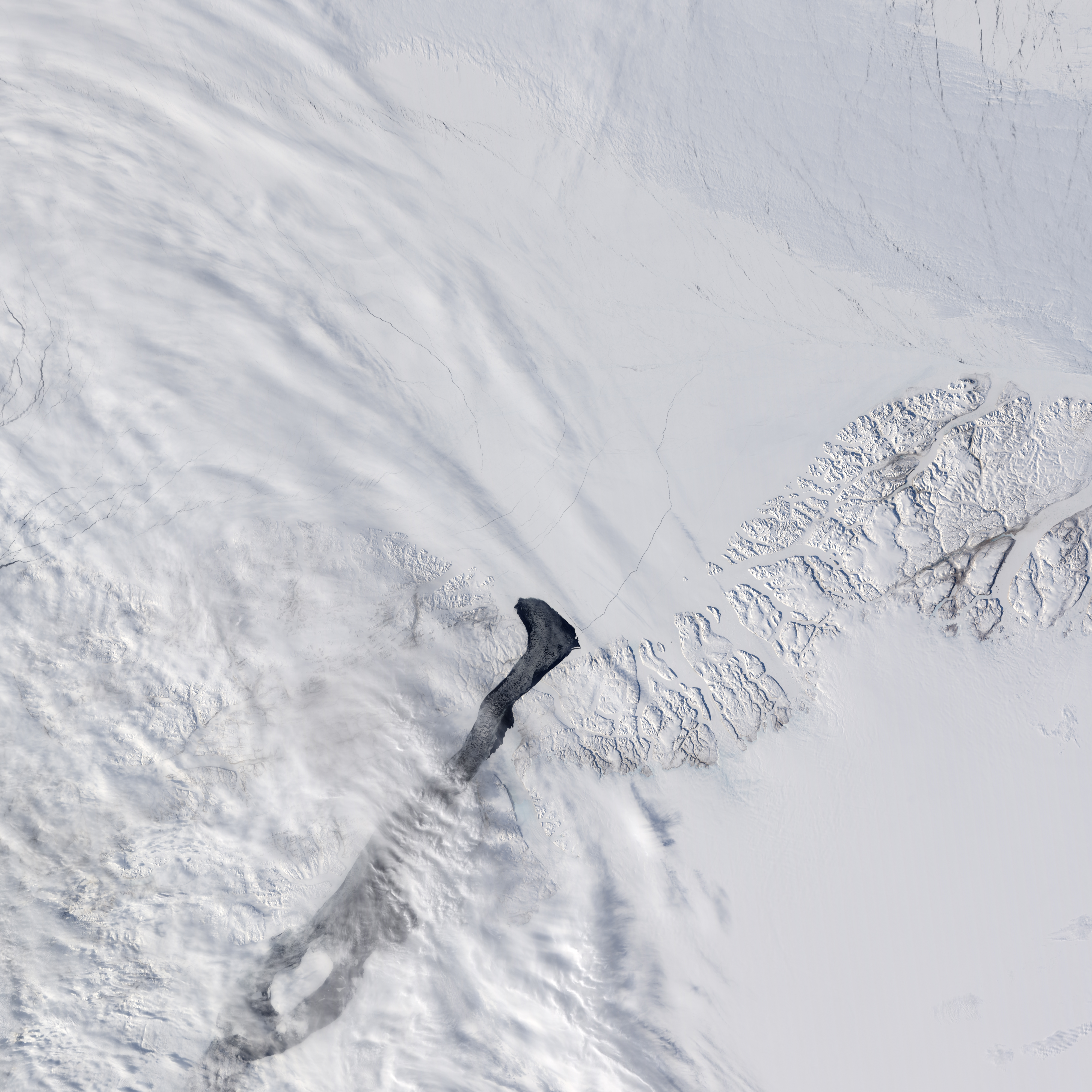
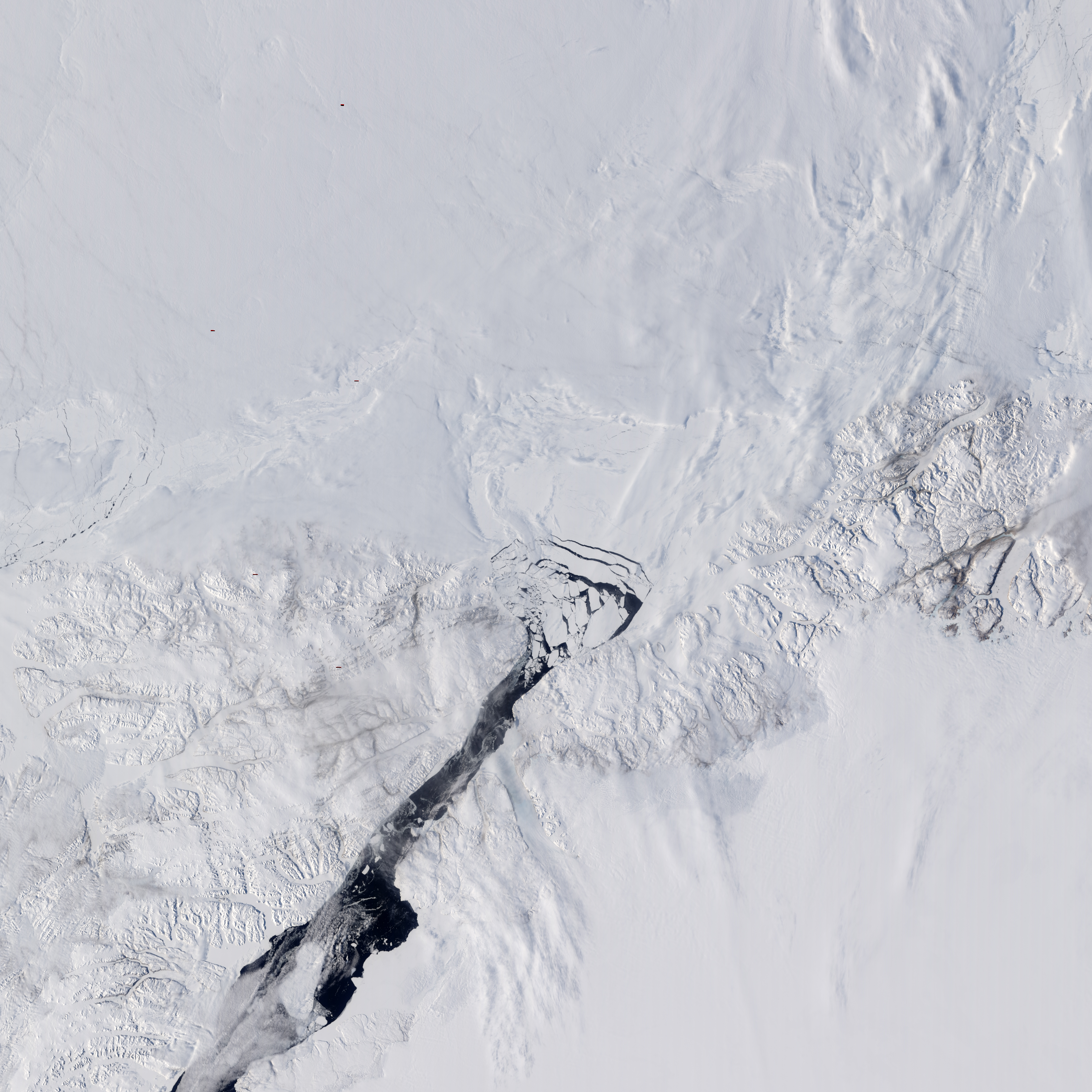
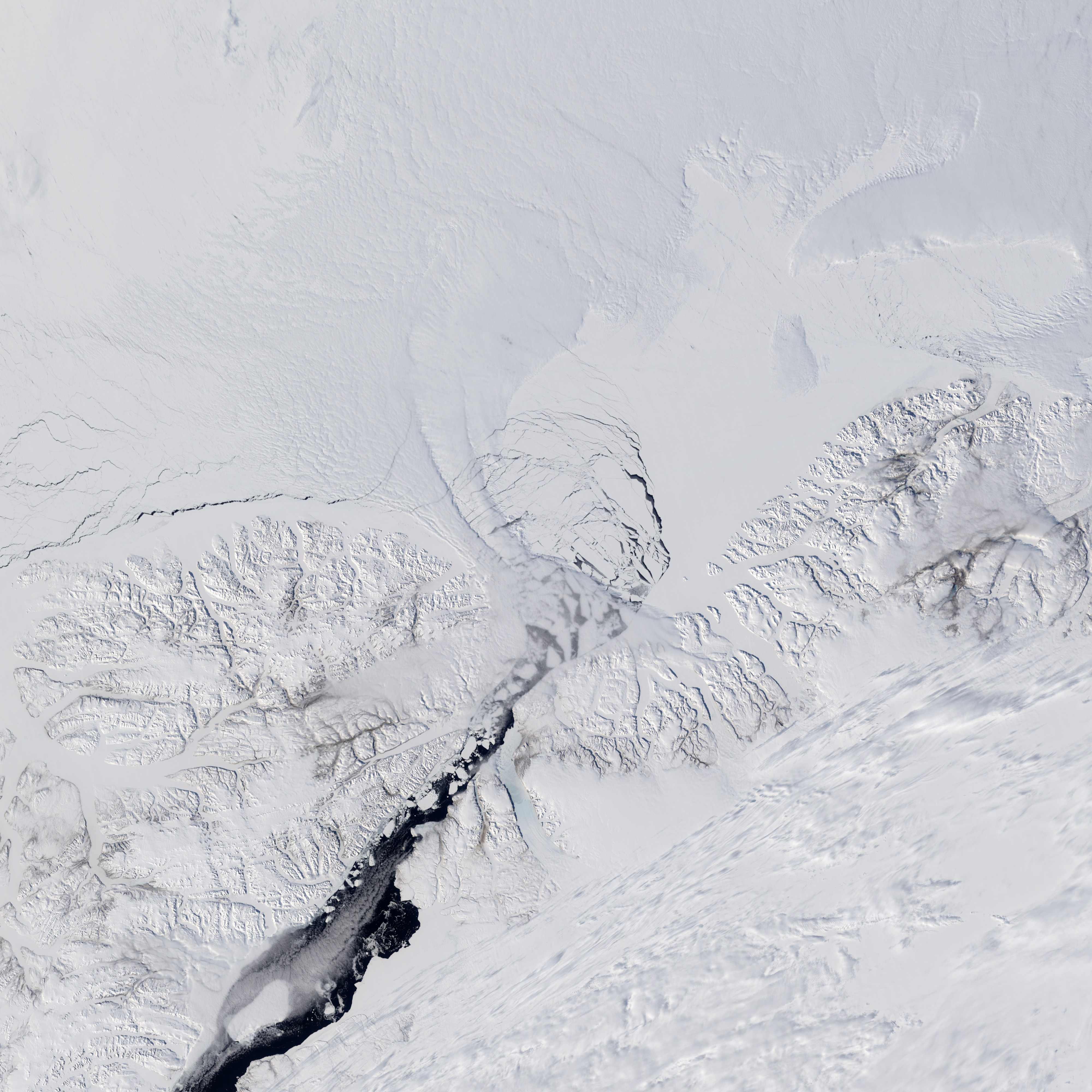
The amount of ice flowing through Nares Strait in 2017 will likely be higher than usual. A key arch of pack ice that blocks other pieces of ice from entering the strait has broken apart earlier than usual. Typically, ice arches form between Ellesmere Island and Greenland in January and break down in early July. In 2017, sensors on NASA satellites observed a key arch breaking down in mid-May. The image on the left was captured on May 9, 2017, when the arch was still intact. By May 12, large pieces of sea ice had begun to break into slivers and move into the strait. By May 17, even more pack ice north of the arch had broken up.
“This breakup is in no way catastrophic,” said Nathan Kurtz, an ice scientist at NASA’s Goddard Space Flight Center. “But it is worth noting that the early breakup of this arch puts some of the oldest and thickest Arctic sea ice in a more vulnerable state and will increase the flow of ice through the strait this year.”
That is not good news because an unusually warm winter means that the overall extent of Arctic sea ice between January and May 17, 2017, had already shrunk well below the 1981-2010 median.
Early breaks of ice arches have happened in this area before. In 2007, unusually warm winter weather prevented this ice arch from forming at all. That doubled the amount of ice that flowed through the strait that year compared to the average, according to an analysis of satellite data led by Ronald Kwok of the Jet Propulsion Laboratory. While that doubling was significant, the total flow of ice through the Nares Strait that year was still just 10 percent of what regularly passes through the larger Fram Strait.
NASA Earth Observatory images by Jesse Allen, using data from the Land Atmosphere Near real-time Capability for EOS (LANCE). Story by Adam Voiland.


