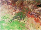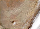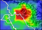
Several days of heavy rains led to widespread flooding on the island of Mindanao, in the southern Philippines. The heaviest rains occurred on February 11-12, 2004, as a steady northeast airflow associated with the winter monsoon persisted across the region. These northeasterly winds interacted with the Diuata Mountains that stretch north-south along the eastern part of the island to intensify the rainfall. Tragically, three people were killed in the province of Agusan del Sur and thousands were left homeless due to the ensuing floods. Numerous landslides were reported, and the Agusan River which runs north-south just west of the Diuata Mountains overflowed its banks.
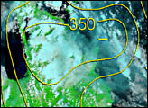
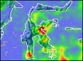
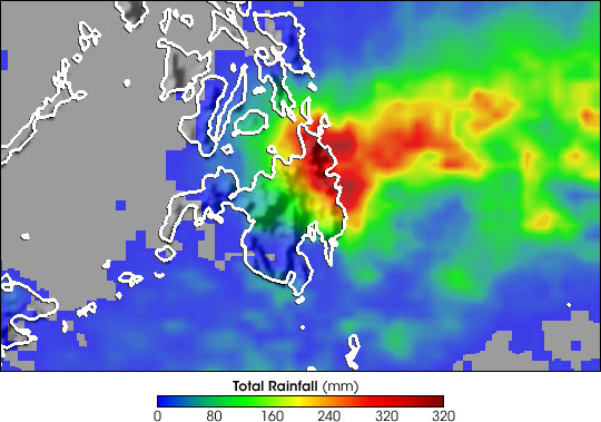
The Tropical Rainfall Measuring Mission (TRMM) based, near-real-time Multi-satellite Precipitation Analysis (MPA) at NASA’s Goddard Space Flight Center monitors rainfall over the global tropics. This image shows MPA-computed rainfall totals for the period February 10-17, 2004. The highest totals are shown to be right over the Diuata Mountains, reaching across the northeast part of the island where as much as 320 mm (16 inches) of rain (darkest reds) are estimated to have fallen. Areas that received on the order of 240 mm (10 inches) of rainfall (red areas) cover most of northeastern Mindanao and extend well out into the Philippine Sea. Amounts drop off sharply towards the western half of the island but are still on the order of 120 mm (5 inches) over the central part of Mindanao.
TRMM is a joint mission between NASA and the Japanese space agency JAXA.
Images produced by Hal Pierce (SSAI/NASA GSFC) and caption by Steve Lang (SSAI/NASA GSFC)