The beleaguered Philippine island of Luzon braced for another storm in late October 2009 as Typhoon Lupit approached from the east. Bloomberg reported that evacuations were underway throughout Luzon in anticipation of more rain. Across the Philippines, more than 860 people had died in the previous two storms, Ketsana and Parma.
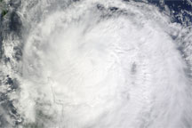
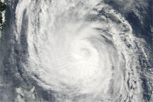
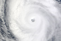
The Moderate Resolution Imaging Spectroradiometer (MODIS) on NASA’s Terra satellite captured this true-color image of Typhoon Lupit at 10:40 a.m. Manila Time (02:40 UTC) on October 22, 2009. Although the eye of Lupit remains offshore, some of the storm’s circling clouds overlap northern Luzon, north of Manila.
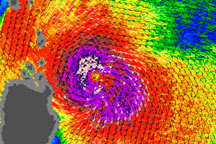
As of 11:00 p.m. Manila time (15:00 UTC) on October 22, 2009, Typhoon Lupit was 300 nautical miles (approximately 560 kilometers) north-northeast of the capital city, having traveled westward over the past several hours, according to the U.S. Navy’s Joint Typhoon Warning Center. At that time, Lupit had maximum sustained winds of 65 knots (120 kilometers) with gusts up to 80 knots (150 kilometers per hour).
NASA image by Jeff Schmaltz, MODIS Rapid Response Team. Caption by Michon Scott.