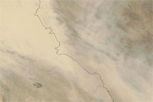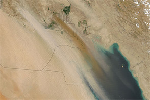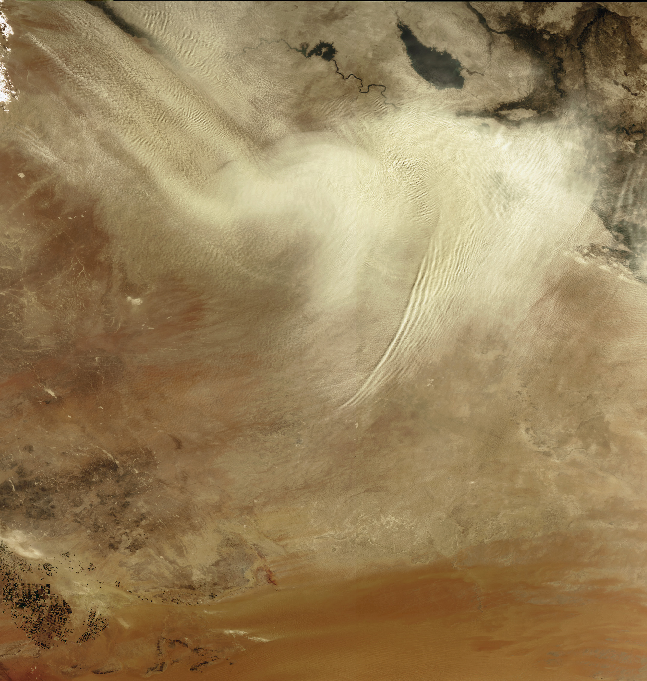
Following the course of the Euphrates River, a large sandstorm swept over Iraq on September 14, 2008. Sandstorms are common in Iraq’s desert terrain, especially during the summer, when a strong northwesterly wind called the shamal blows over the floodplain of Iraq’s Tigris and Euphrates Rivers. The wind was picking up dust at distinct point sources in the northwest (upper left corner). Dust rises from these sources in distinct plumes that blend together as they blow southeast. The thick dust ripples across the atmosphere, taking on the shape of the turbulent air.
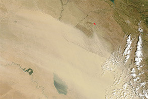
The teardrop-shaped body of water in the upper right corner is Lake Tharthar, which is 120 kilometers north of Baghdad between the Tigris River, the dark line east of Tharthar, and the Euphrates River, visible to the west of Tharthar. The Medium Resolution Imaging Spectrometer (MERIS) flying on the European Space Agency’s Envisat captured this photo-like image. The dust had thinned and moved southeast towards the Persian Gulf when the Moderate Resolution Imaging Spectroradiometer (MODIS) on NASA’s Aqua satellite viewed the storm on September 16.
Dust storms can be a major contributor to reduced air quality and can cause hazards to human health. Wind-borne dust particles can invade the respiratory system’s natural defenses and lodge in the bronchial tubes, increasing the number and severity of asthma attacks, causing or aggravating bronchitis, and reducing the body’s ability to fight infections. Dust storms can also cause major ecological and agricultural damage.
The large image provided above is at MERIS’ full resolution of 300 meters per pixel.
Image courtesy the European Space Agency. Caption by the ESA and Holli Riebeek.