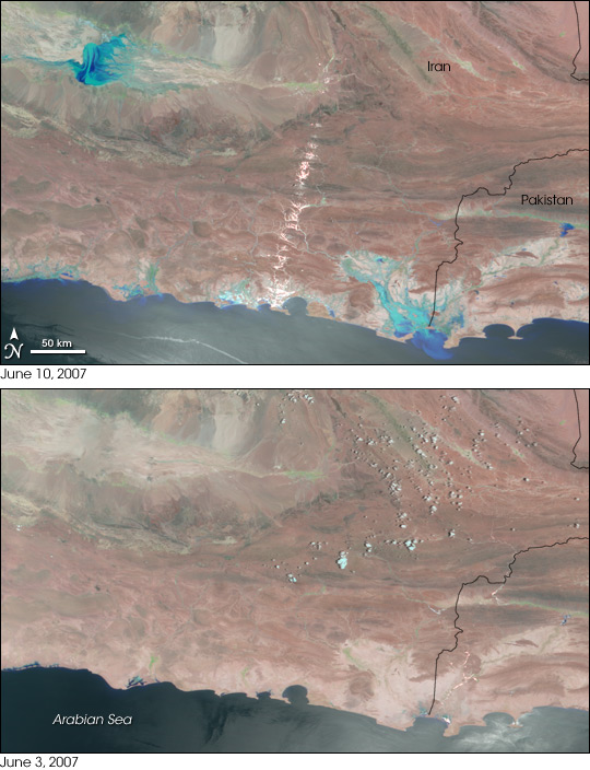
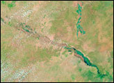
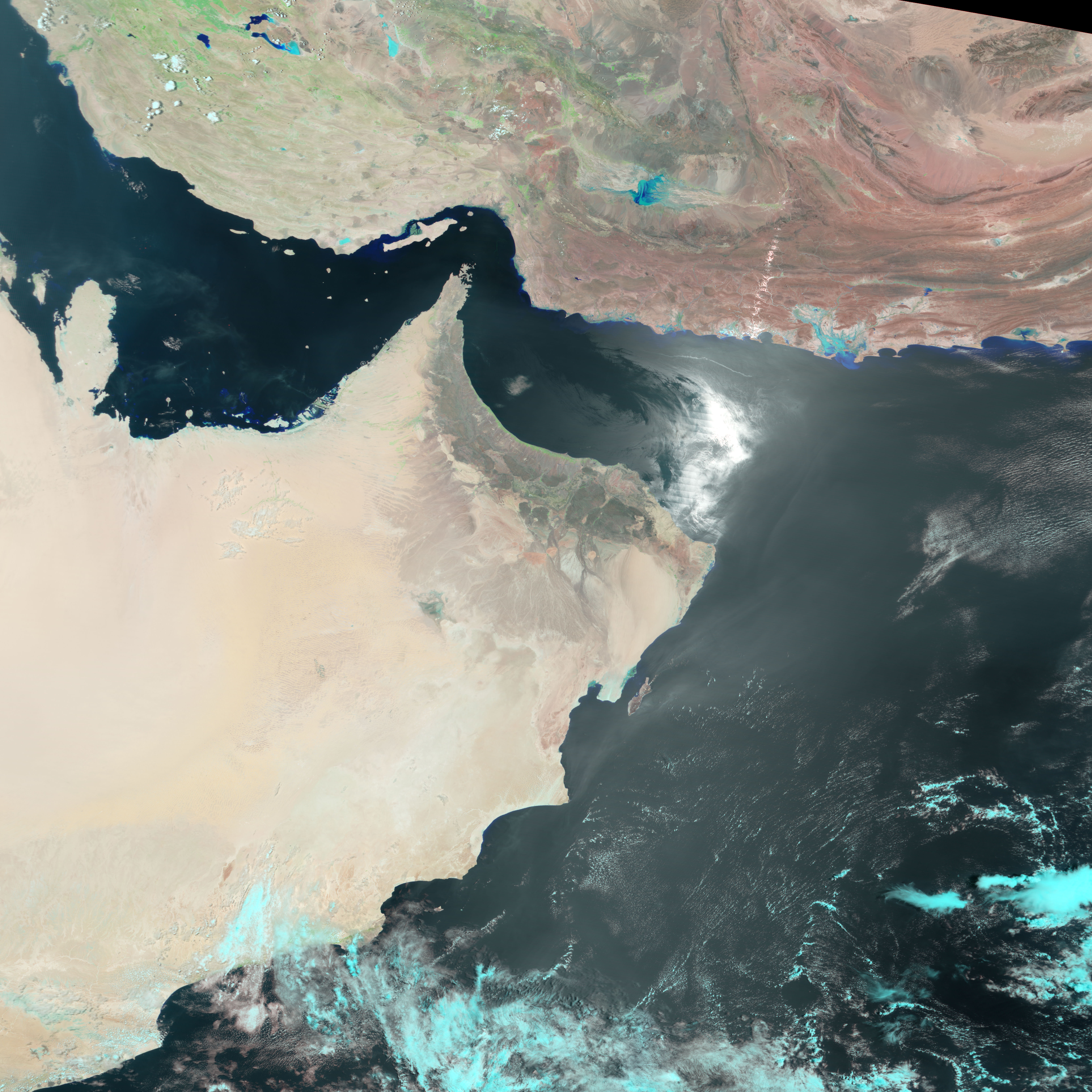
When the last of the clouds trailing Cyclone Gonu cleared on June 10, 2007, the Moderate Resolution Imaging Spectroradiometer (MODIS) on NASA’s Terra satellite recorded extensive flooding along Iran’s southeastern coast. Ranging from turquoise to dark blue, streams of water contrast starkly with the bare, tan-pink desert in the top image. The worst of the flooding is concentrated in two places. Along the coast, near the Pakistan border, the Koja River and its tributaries have overflowed. Less extensive flooding is visible along the entire coastline shown in this image. The second area of heavy flooding is inland in the upper left corner of the image. The bright diagonal stripe across the center of the image is the Sun’s reflection off the desert’s surface.
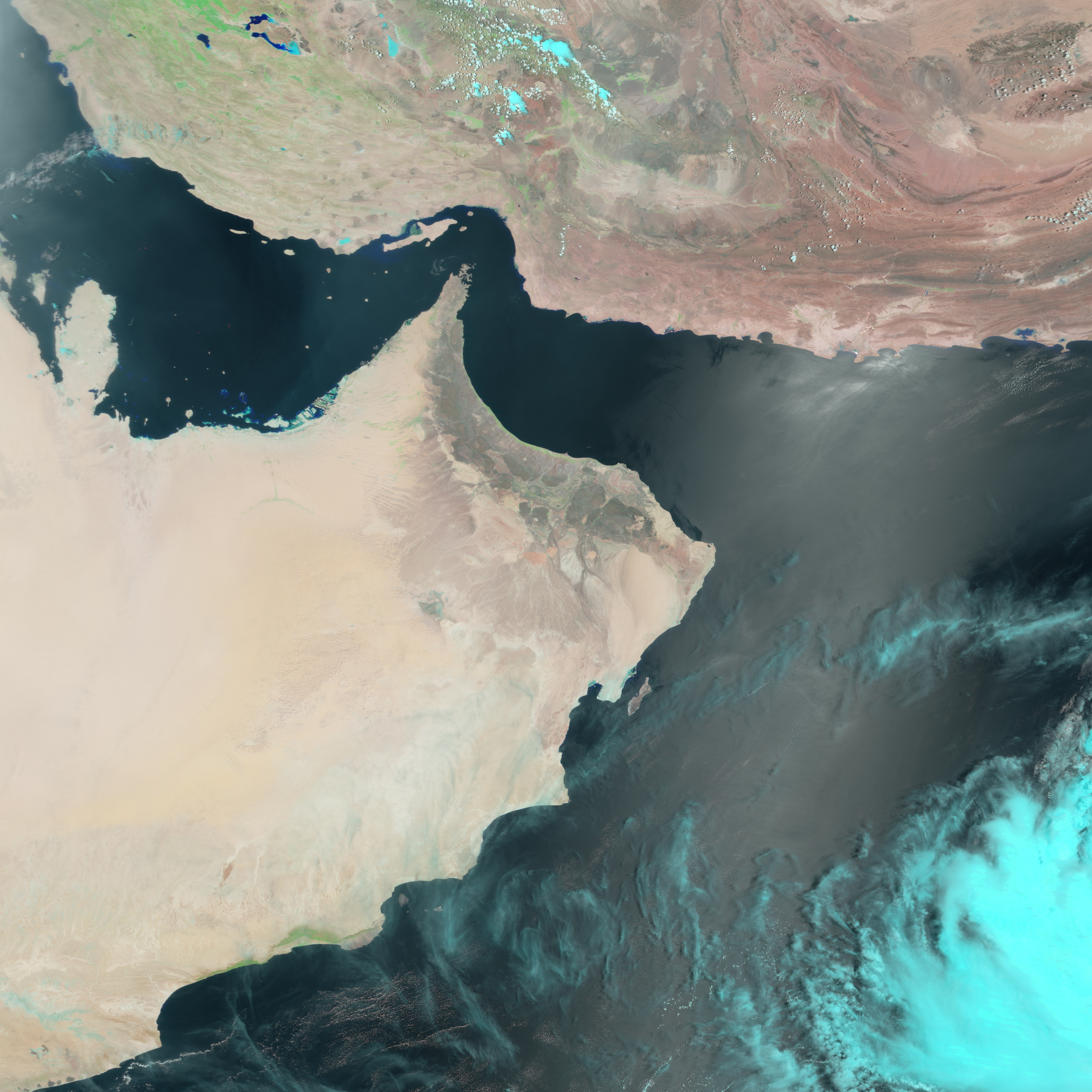
The lower image, taken on June 3, 2007, shows conditions immediately before the storm struck. Both images were made with a combination of visible and infrared light. In this type of image, water is black or dark blue. Fine desert sand mixed with the water gives it a lighter blue color in this image. Bare land, which dominates the scene, is tan-pink, while tiny patches of plant-covered land are green. Clouds are pale blue and white.
Flooding in southern Iran isolated approximately 40,000 people in the wake of Cyclone Oman, reported IranMania on June 10. The storm came ashore over the region on June 6, bringing strong winds and heavy rain. The rare cyclone was the strongest storm to hit the region since 1945. As of June 10, 70 deaths had been attributed to the storm in both Iran and Oman.
NASA image created by Jesse Allen, using data provided courtesy of the MODIS Rapid Response team. Caption by Holli Riebeek.


