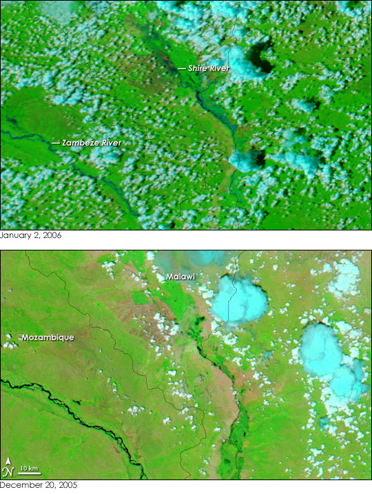
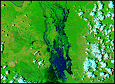
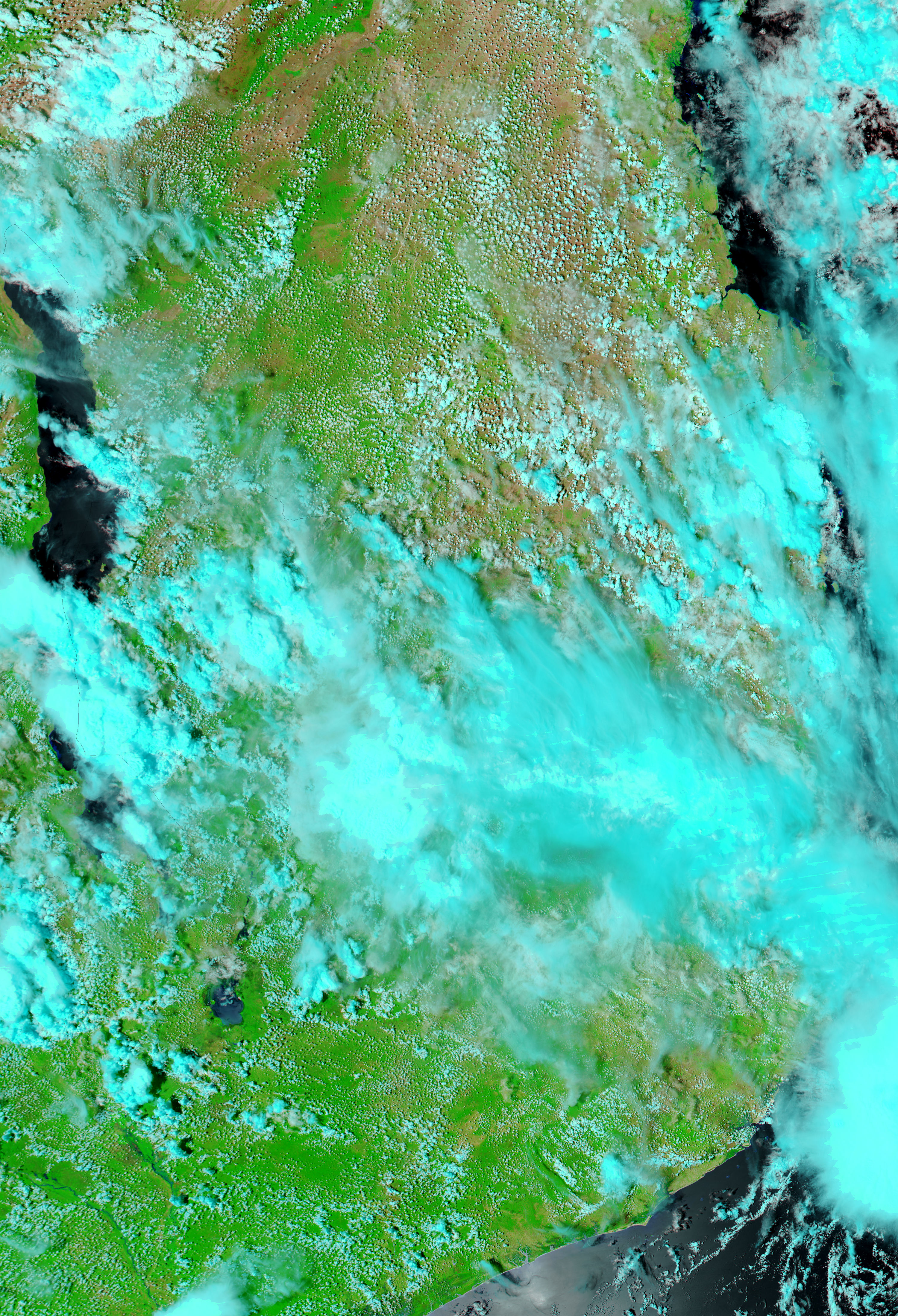
Heavy rain is a part of life in Malawi and Mozambique in December and January. In these southern African countries, the two months fall in the middle of the rainy season, which runs from November to March. Though not quite as predictable as the rain, flash flooding is also common in the river valleys of southern Malawi during the rainy season. In late December 2005 and early January 2006, the rains were far more intense than normal, and true to form, the Shire River ran over its banks, displacing thousands of people, according to news reports.
This pair of Moderate Resolution Imaging Spectroradiometer (MODIS) images show what two weeks of heavy rain have done to the region. In the false-color images, both taken by MODIS on NASA’s Aqua satellite, water is black or dark blue. Clouds are pale blue, and plant-covered land is bright green. Bare earth is pinkish tan. In the two weeks that elapsed between December 20, 2005, lower image, and January 2, 2006, top, the land turned a deep green as plants sprang up. The Shire River, not even visible in December, expanded, soaking the land with a smudge of blue.
Disruptive though the floods may be, the rains were a mixed blessing. In 2005, the rains failed during February, and crops suffered. The ensuing food shortages and hunger caused the government to declare a national disaster in early December. The rich agricultural land surrounding the Shire River was among the regions most severely affected by the drought. The December and early January rains fell just as farmers were planting the primary crop of the year, but continued rainfall will still be needed to guarantee that the harvest will be better in 2006.
The large images provided above are at MODIS’ maximum resolution of 250 meters per pixel. The MODIS Rapid Response Team provides daily images of the region in a variety of resolutions.
NASA images courtesy the MODIS Rapid Response Team at NASA GSFC.


