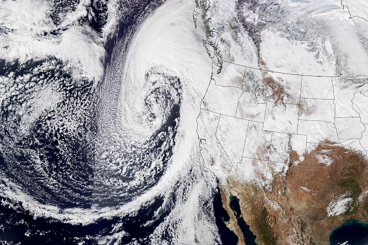
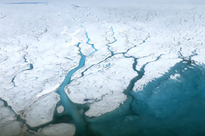
Greenland is home to the planet’s largest ice sheet outside of Antarctica. Observations collected from the ground, air, and space, have revealed rapid thinning in the northeast part of this ice sheet that could contribute more to sea level rise than previously thought.
“Rivers” of relatively fast-moving ice, known as ice streams, generally flow from Greenland’s interior toward its coasts. The Northeast Greenland Ice Stream is the island’s largest, draining ice from a basin that spans about 12 percent of the ice sheet. Much of that land-based ice eventually flows through two main outlet glaciers, where it discharges icebergs and melts into the ocean.
Shfaqat Abbas Khan, a scientist at the Technical University of Denmark, and colleagues recently found that the Northeast Greenland Ice Stream is speeding up and thinning, not only at its margins but also far inland. A team of ice sheet modelers at Dartmouth College then used these data to revise their projections of the ice stream’s contribution to sea level rise, which they say is expected to be six times larger than models previously indicated by the end of the century. The research was published in the journal Nature.
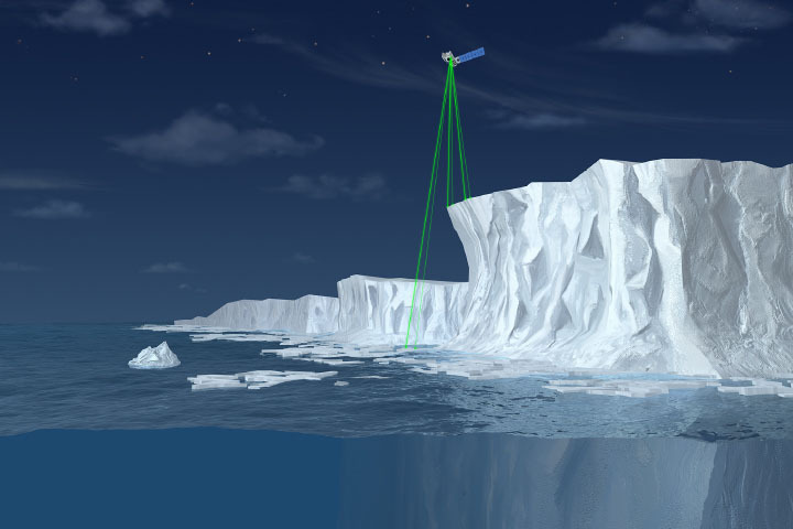
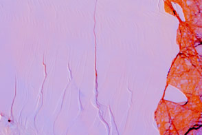
This animation simulates the cumulative thinning of the Greenland Ice Stream since 2007 and projected through 2100. It is based on a model that provided the best match with observations of ice elevation collected from 2007 to 2021. The observations came from NASA’s Operation IceBridge airborne mission, NASA’s Ice, Cloud, and land Elevation Satellite-2 (ICESat-2), and the European Space Agency’s (ESA) CryoSat-2 satellite.
Yellow areas are where the simulation shows the greatest amount of thinning, adding up over the years to more than 200 meters in places. Model results indicate that by the end of the century, areas where ice is thinning by 2 to 4 meters per year will have spread up to 250 kilometers inland.
“Our simulations suggest that the Northeast Greenland Ice Stream will contribute between 13.5 to 15.5 millimeters to sea level rise by 2100,” Khan said. “This is mainly because of inland thinning and speed-ups, which were not captured in previous models. Thinning and speed-ups are not limited to ice marginal regions but propagate deep into the interior.”
The model also matched well with observations of the ice stream’s speed and acceleration. Those observations were made with ESA’s Sentinel-1 satellites and with a network of GPS stations installed on the ice stream in 2016 in collaboration with Eric Rignot of the University of California, Irvine, and NASA’s Jet Propulsion Laboratory.
“GPS data together with satellite data to detect inland flow accelerations could be useful to improve our understanding of how the ice sheets are affected by climate change and reduce the uncertainty in sea level rise projections,” Khan added. “A similar approach should be applied to other large glacier systems, such as Pine Island or Thwaites glaciers in Antarctica that have shown in recent decades significant changes in flow speed and thinning near the margin and far into the interior of the continent.”
NASA Earth Observatory video by Joshua Stevens, using data courtesy of Khan, S.A., et al. (2022). Story by Kathryn Hansen.