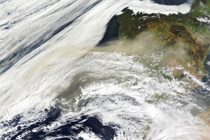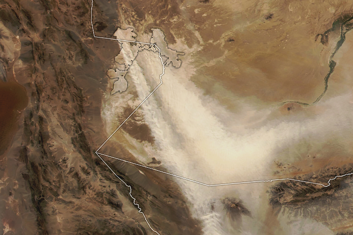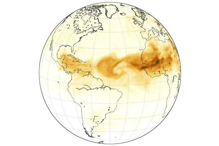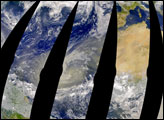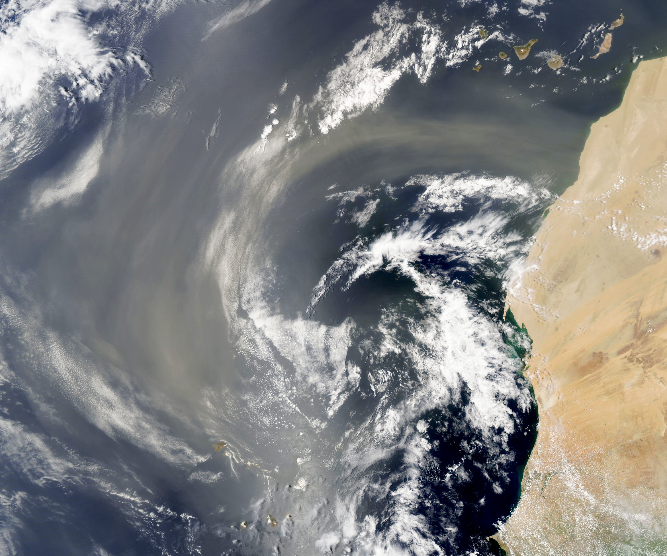
For much of July 2022, easterly winds have carried large plumes of Saharan dust over the Atlantic Ocean. At times, dust in the Saharan Air Layer has traveled as far as the Caribbean, Texas, and Florida. In South Florida, meteorologists linked the incoming dust to hazy skies, striking sunsets, and reduced rainfall.
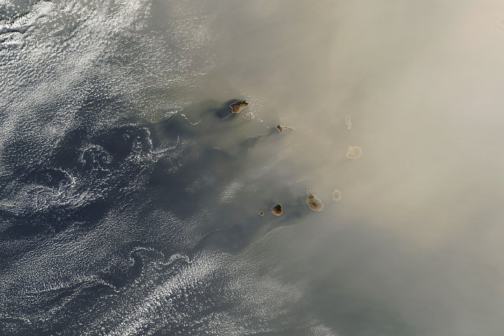
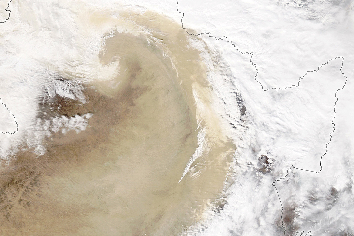
On July 26, 2022, the Moderate Resolution Imaging Spectroradiometer (MODIS) on NASA’s Aqua satellite captured a natural-color image (above) of a fresh plume of dust as it streamed over Western Sahara. The next day, the same sensor acquired an image (below) of clouds swirling through dusty skies downwind of the Portuguese island of Madeira. Other natural-color satellite imagery from July 4 to July 27 shows this latest pulse of dust is just one of many in recent weeks.
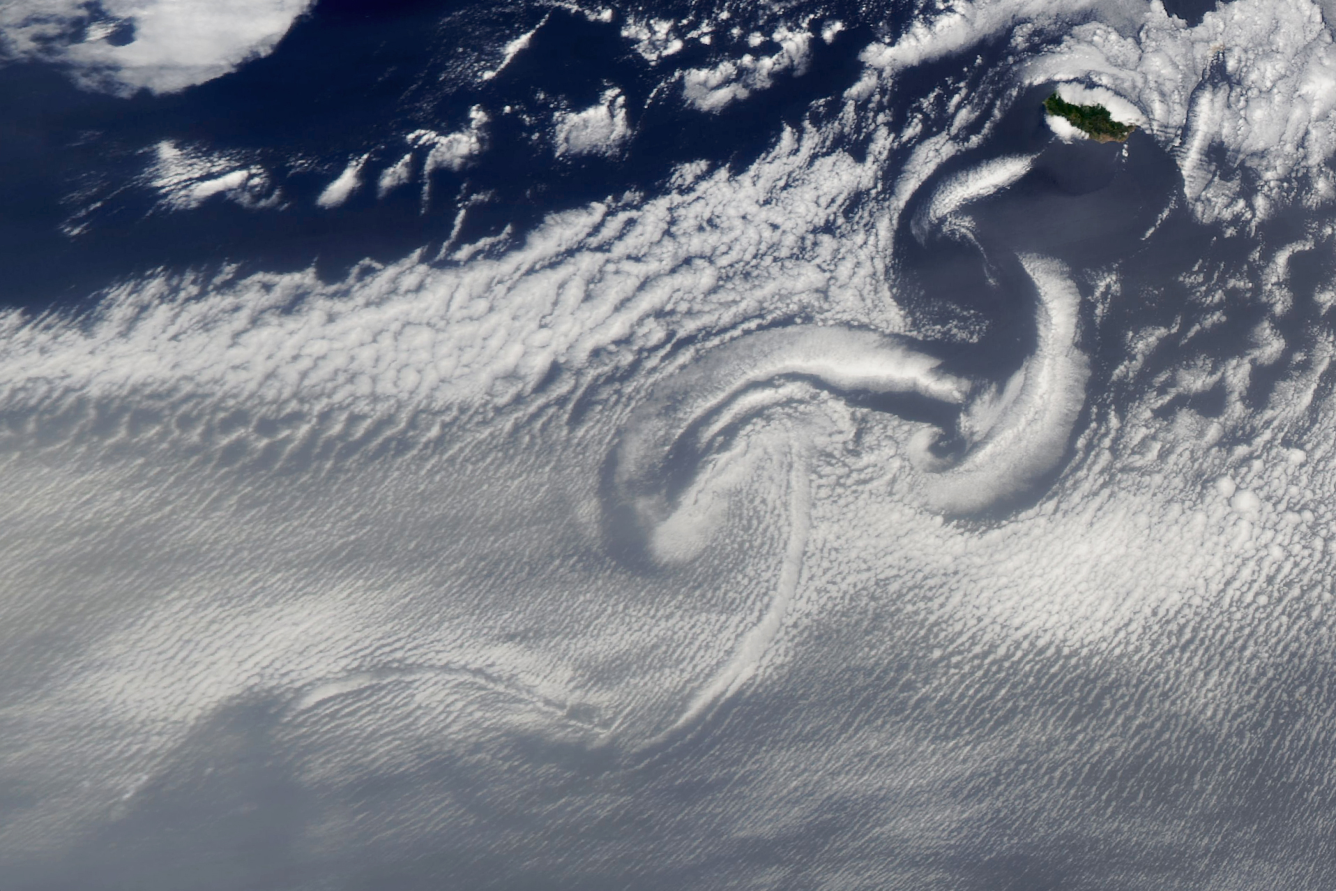
The spiraling cloud patterns near Madeira are the result of a von Kármán vortex street, a repeating pattern of vortices that swirl in alternating directions. The pattern can occur any time a fluid moves around a bluff body that separates the flow. In this case, the vortices were formed by air masses moving around Madeira. At its highest point, the island rises 1,861 meters (6,106 feet) above sea level.
Dust plays a major role in Earth’s climate and biological systems. Since it is rich with iron and other minerals that plants and phytoplankton need, it provides natural fertilizer for ecosystems when it lands downwind. The airborne particles also absorb and reflect sunlight—altering the amount of solar energy reaching the planet's surface. Dust can also promote or reduce cloud and storm formation, depending on other atmospheric conditions.
“Most hurricane experts think that the Saharan Air Layer is bad for hurricanes,” explained University of Miami meteorologist Brian McNoldy. “Not only does it contain dry air, but there's typically a layer of high wind shear associated with it. Hurricanes hate both of those things.”
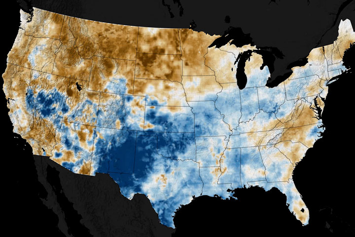
So far this season, McNoldy says the three named storms in the Atlantic have an accumulated cyclone energy that’s about 41 percent of average for this point in the season. “That’s quiet, but things can turn around in a blink of an eye with just one hurricane,” he said. “If we’re still at 41 percent of average at the end of September, that would be a definite sign of a quiet season.”
NASA Earth Observatory images by Lauren Dauphin, using MODIS data from NASA EOSDIS LANCE and GIBS/Worldview. Story by Adam Voiland.