Flooding is an annual problem in Sudan in August and September. Around that time each year, monsoon rains pour into the Ethiopian Highlands and flow down to the Blue Nile and White Nile. As the rivers wind through Sudan and South Sudan on their way toward the city of Khartoum, floodwaters can swamp nearby communities.
September 2021 fit that pattern. Starting in August, a series of torrential downpours overwhelmed streams and rivers, unleashing floods that have affected hundreds of thousands of people and destroyed tens of thousands of homes across the northeastern Africa nations. Some of the hardest hit areas are in the state of White Nile in Sudan. According to the U.N. Office for the Coordination of Humanitarian Affairs (OCHA), more than 94,000 people in White Nile have been affected by flooding. Between 12,000 and 16,000 people were stranded by floodwaters and in urgent need of evacuation, according to an OCHA update published on September 16, 2021. More than 20,000 people have already been evacuated.
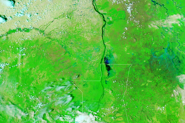
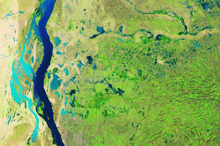
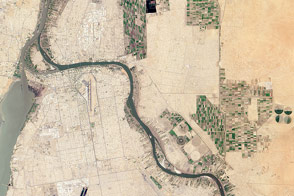
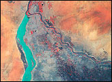
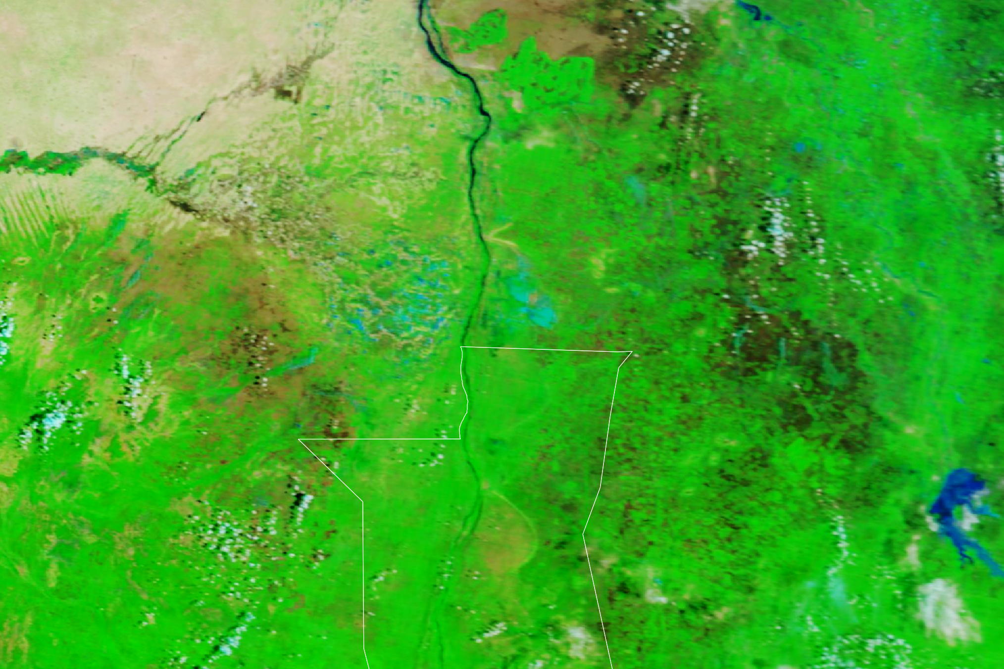
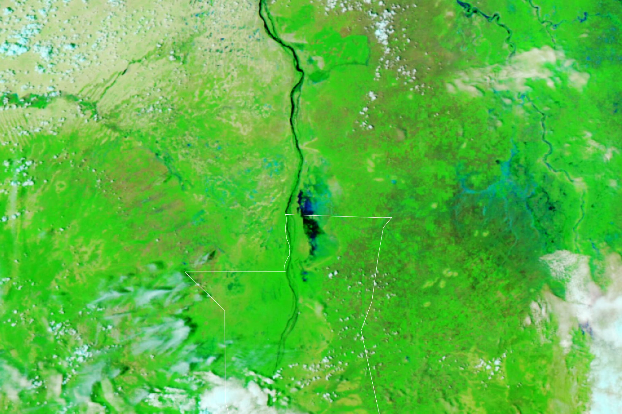
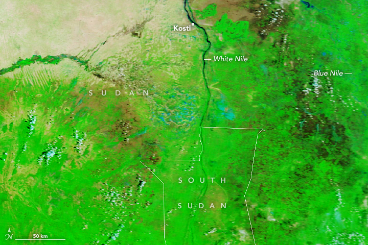
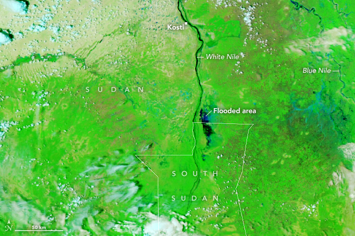
On September 16, 2021, the Visible Infrared Imaging Radiometer Suite (VIIRS) on NOAA-20 acquired a false-color image of flooding near the border of Sudan and South Sudan. The image is centered on flooding in the Al Jabalain district of White Nile State, an area where local authorities are reporting “catastrophic” conditions. Among the flooded areas are camps that house large numbers of refugees and internally displaced people who have fled their homes due to civil war, food shortages, or earlier floods. For comparison, the other image shows the same area in September 2015, a year when flooding did not cause major problems in this area.
In addition to harming people and destroying homes, floods in Sudan often contribute to regional food insecurity by killing livestock and damaging crops. White Nile is facing what the Famine Early Warning Systems Network has classified as “crisis” levels of food insecurity.
River gauges downstream in Shandi, Khartoum, and Atbara showed water levels on the White Nile remained above or near flood stage on September 16, 2021, though water levels had declined from a few days earlier. So far the flooding in 2021 appears to be less extreme than in 2020, when record-breaking flooding affected about 850,000 people, according to OCHA.
NASA Earth Observatory images by Lauren Dauphin, using Landsat data from the U.S. Geological Survey. Story by Adam Voiland.