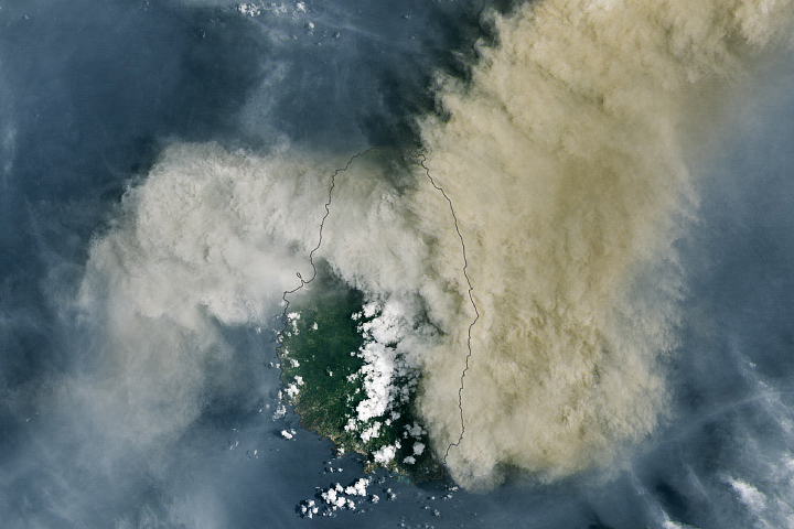
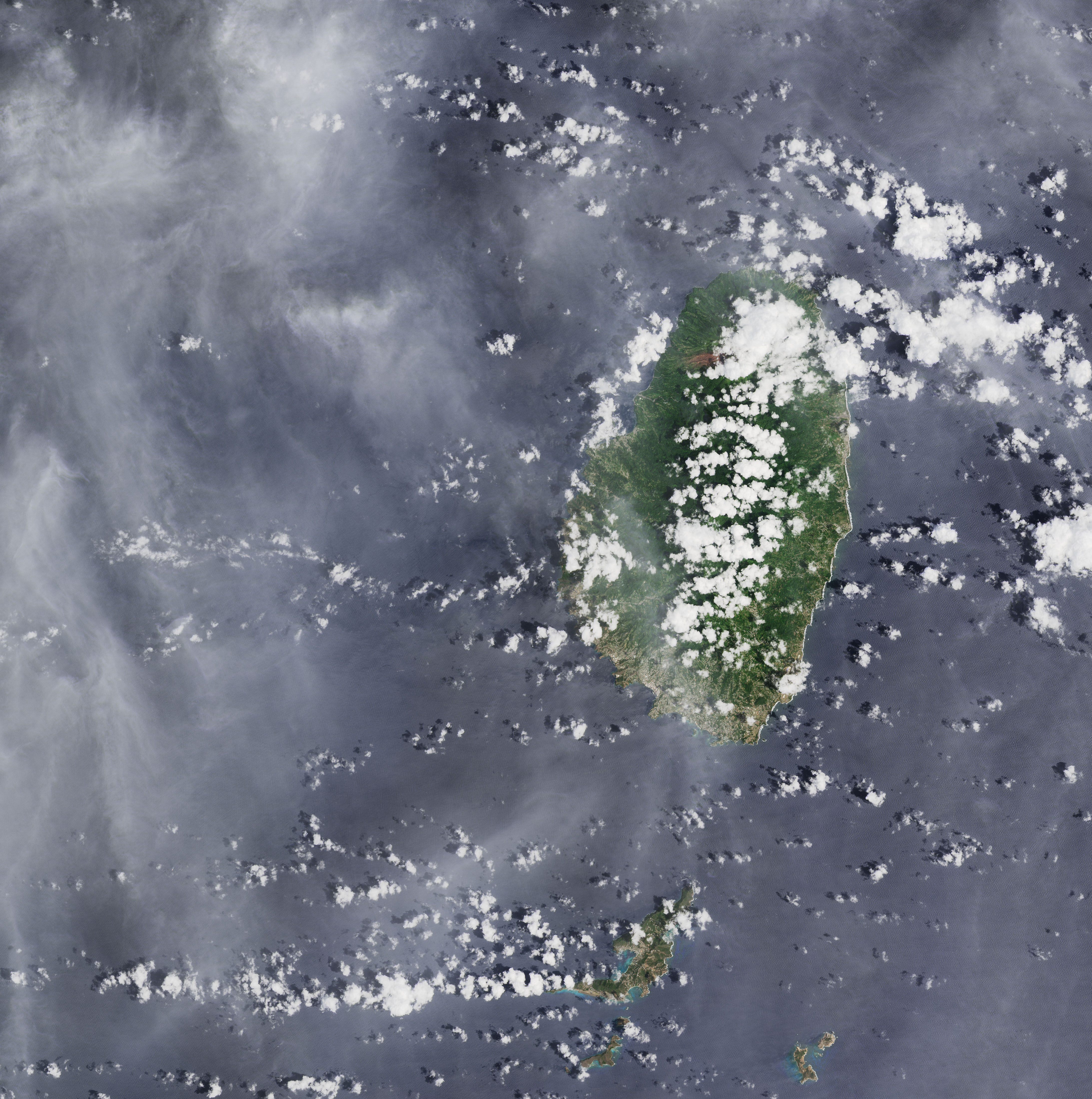
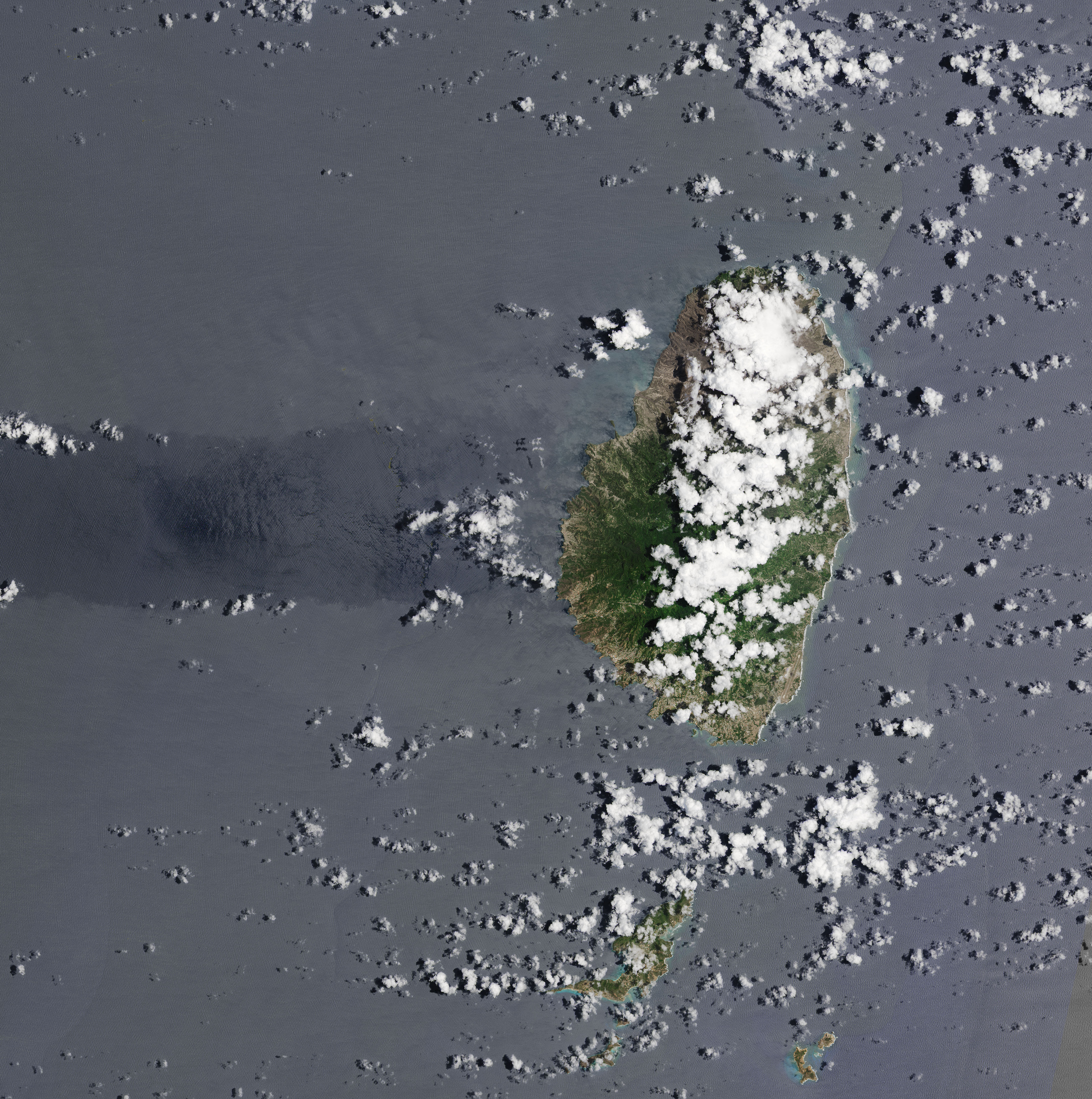
Beginning on April 9, 2021, intermittent explosive eruptions from La Soufriére volcano have hurled plumes of ash and gas high into the air above the Caribbean island of Saint Vincent. Although winds have carried some ash plumes great distances, clouds of the tiny pulverized rock and glass shards have also rained down on the island and the Atlantic Ocean.
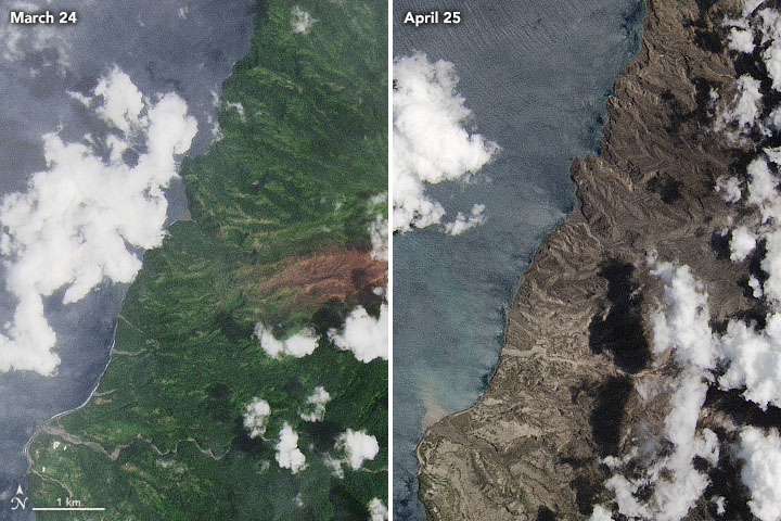
The fallout has coated large parts of Saint Vincent. The images above, acquired by the Operational Land Imager (OLI) on Landsat 8, show the northwestern part of the island before and after two weeks of powerful eruptions and ashfalls. The brown scar in the vegetation in the image on the left was caused by damage from gases leaked by the volcano before it erupted explosively.
Volcanic ash is quite different than the soft, fluffy material you might find in a fireplace, and the sharp edges and other properties of volcanic particles make them especially problematic. Ash plumes pose a threat to aircraft because the particles can damage jet engines, propellers, and other aircraft systems in ways that can cause them to fail. Roughly ten times denser than snow, ash also can accumulate into heavy layers that can smother crops, collapse roofs, and taint water supplies. When soaked by rain, it can form slurries of muddy debris called lahars that rush down slopes and into valleys. Wet volcanic ash can even conduct electricity, meaning it can trigger short circuits and the failure of some electronic equipment.
The layers of ash that fell on Saint Vincent in April 2021—along with several pyroclastic flows of hot debris rushing down La Soufriére’s slopes—have caused widespread destruction. Most island residents and tourists evacuated the most affected areas in time, but large numbers of buildings were flattened and farms and infrastructure have sustained extensive damage.
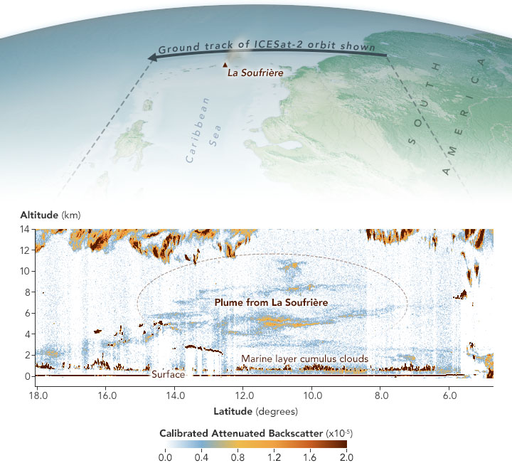
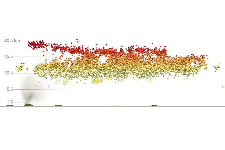
The data visualization above offers a view of the vertical distribution of ash in the atmosphere over the Atlantic Ocean about 300 kilometers (200 miles) downwind from La Soufriére. The data were collected on April 12, 2021, by the Advanced Topographic Laser Altimeter System (ATLAS) on NASA’s ICESat-2. Note that much of the ash lingered at heights ranging from 4 to 10 kilometers.
The instrument was designed to measure changes—on the scale of centimeters—in ice and land surfaces. In fact, volcanologists at the University of Buffalo are using ICESat-2 data to identify small bulges in volcanic domes that can precede explosive eruptions. They hope such observations might someday aid warnings about imminent eruptions.
ATLAS can make observations of the atmosphere up to a height of 14 kilometers (9 miles). Though the ICESat-2 mission is focused on measurements of icy surfaces, it collects data relevant to atmospheric features like wildfire smoke, dust, clouds, blowing snow, and the height of the planetary boundary layer. Since real-time data showing the height of volcanic plumes is often scarce, data like this can serve as an important tool for atmospheric scientists developing ash dispersion models.
A few other satellite sensors can also measure plume height, but having multiple sensors tracking an eruption increases the chances that one will make a measurement in near-real time, which is useful for aviation safety and air quality warnings. “One of the most important things about this type data is that it shows the vertical distribution of the plume,” said Stephen Palm, a research meteorologist based at NASA’s Goddard Space Flight Center. “That’s key to getting warnings to aircraft pilots.”
“I don’t think the volcanology community is well aware of ICESat-2 atmospheric data,” said Michigan Tech volcanologist Simon Carn. “However, it certainly provides useful atmospheric observations, especially when ash is dense and at night.”
A new rapid-response browsing tool for ICESat’s atmospheric data is available here.
NASA Earth Observatory images by Joshua Stevens, using Landsat data from the U.S. Geological Survey, and ICESat-2 data from the National Snow & Ice Center courtesy of Stephen Palm/NASA GSFC. Story by Adam Voiland.


