Eruptions at La Soufrière volcano have propelled ash and gas high into the air over the Caribbean islands of Saint Vincent and Barbados. The eruption—the volcano’s first explosive event since 1979—prompted thousands of people to evacuate.
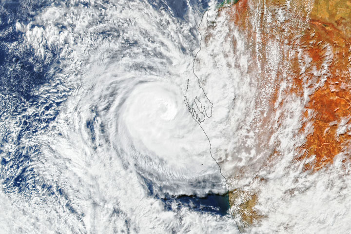
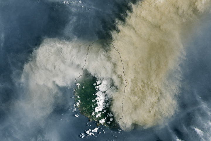
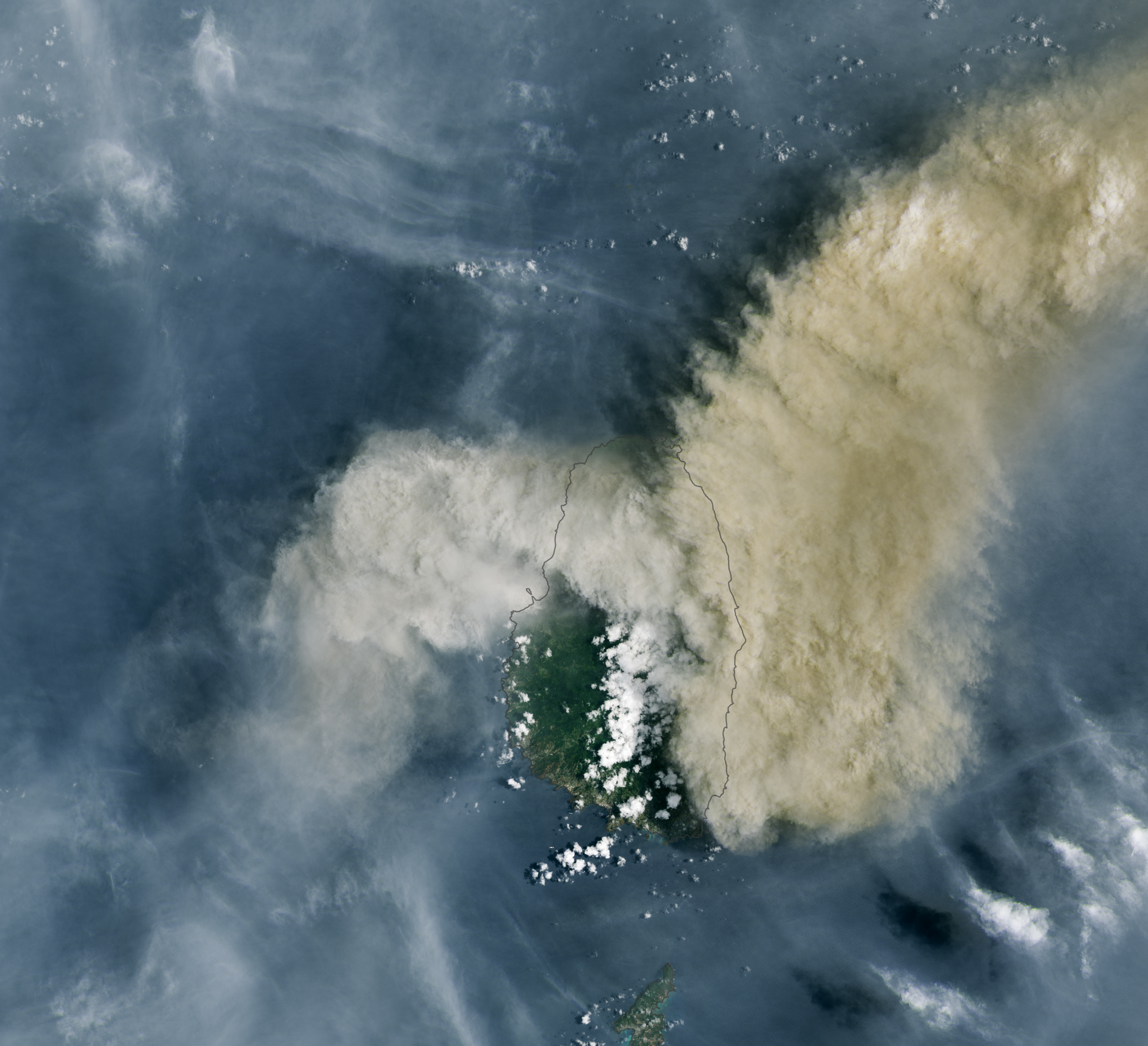
The recent bout of explosive activity began on April 9, 2021. At about 10:30 a.m. local time that day, the Operational Land Imager (OLI) on Landsat 8 acquired this image of volcanic ash billowing from La Soufrière. The plume obscures the volcano below, a peak that stands 1178 meters (3,864 feet) above sea level on the northern side of Saint Vincent.
According to Jean-Paul Vernier, an atmospheric scientist with NASA’s Earth Applied Sciences Disasters Program, activity was apparent months before the explosive eruptions. It started with an effusive eruption in which magma that reached the surface slowly built up a lava dome. In April, the dome “finally turned out a massive explosion without many precursor signs,” Vernier said. Explosive eruptions result from the rapid expansion of pressurized gasses trapped in the rock or magma; the pressure violently breaks rocks apart and produces a plume of rock, ash, and gas.
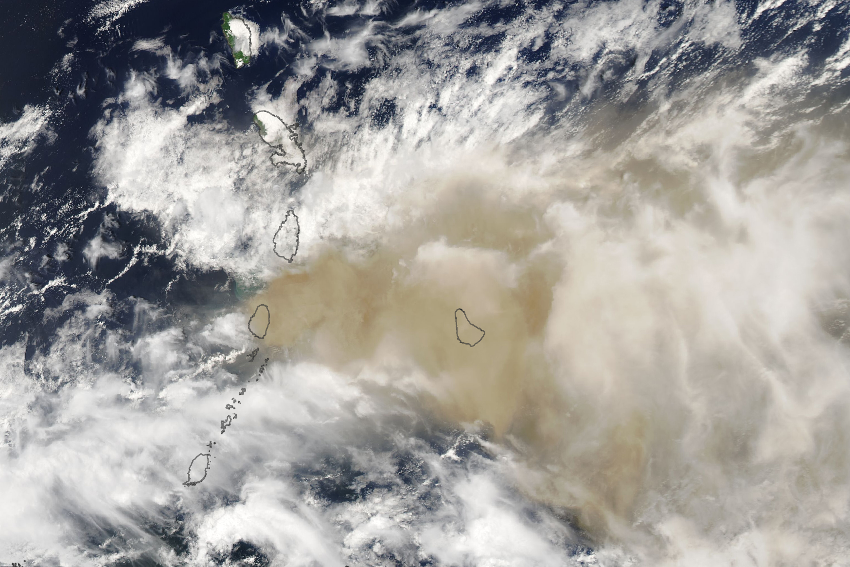
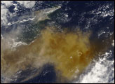
Winds carried much of the ash and gas east from Saint Vincent. On the afternoon of April 10, 2021, the Moderate Resolution Imaging Spectroradiometer (MODIS) on NASA’s Aqua satellite acquired this image showing ash reaching Barbados, 190 kilometers (120 miles) away. Clouds (white) are also abundant in this view.
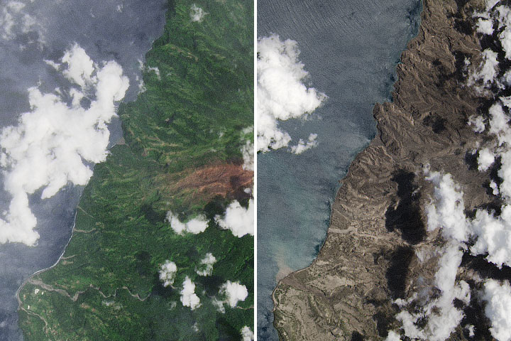
These images show ash aloft in the atmosphere, but some of it fell back to the ground. According to news reports, ashfall has blanketed parts of Saint Vincent and Barbados. It also has threatened food and water supplies on Saint Vincent and has reduced visibility, which can complicate evacuation efforts. People displaced to the island’s southern side—away from the volcano and generally safer—still had to contend with falling ash and poor air quality.
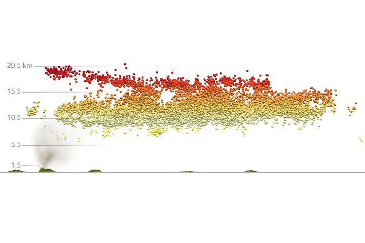
Scientists are investigating the extent and height reached of the ash and gas plume. They think some ash has risen all the way into the stratosphere, where strong winds can potentially carry it great distances. Other satellite instruments have detected sulfur dioxide reaching Cape Verde, an archipelago in the central Atlantic Ocean. Sulfur dioxide near ground level can irritate the human nose and throat; higher in the atmosphere it can make sulfuric acid aerosols and, in extreme cases, lead to a cooling effect.
The NASA Disasters team is working with several science institutions and agencies to continue assessing the eruption and to make data available to emergency responders and aid groups. “Our program has been working with stakeholders in the region since the first signs of the eruption,” Vernier said.
NASA Earth Observatory images by Lauren Dauphin, using Landsat data from the U.S. Geological Survey and MODIS data from NASA EOSDIS LANCE and GIBS/Worldview. Story by Kathryn Hansen.