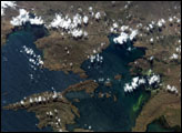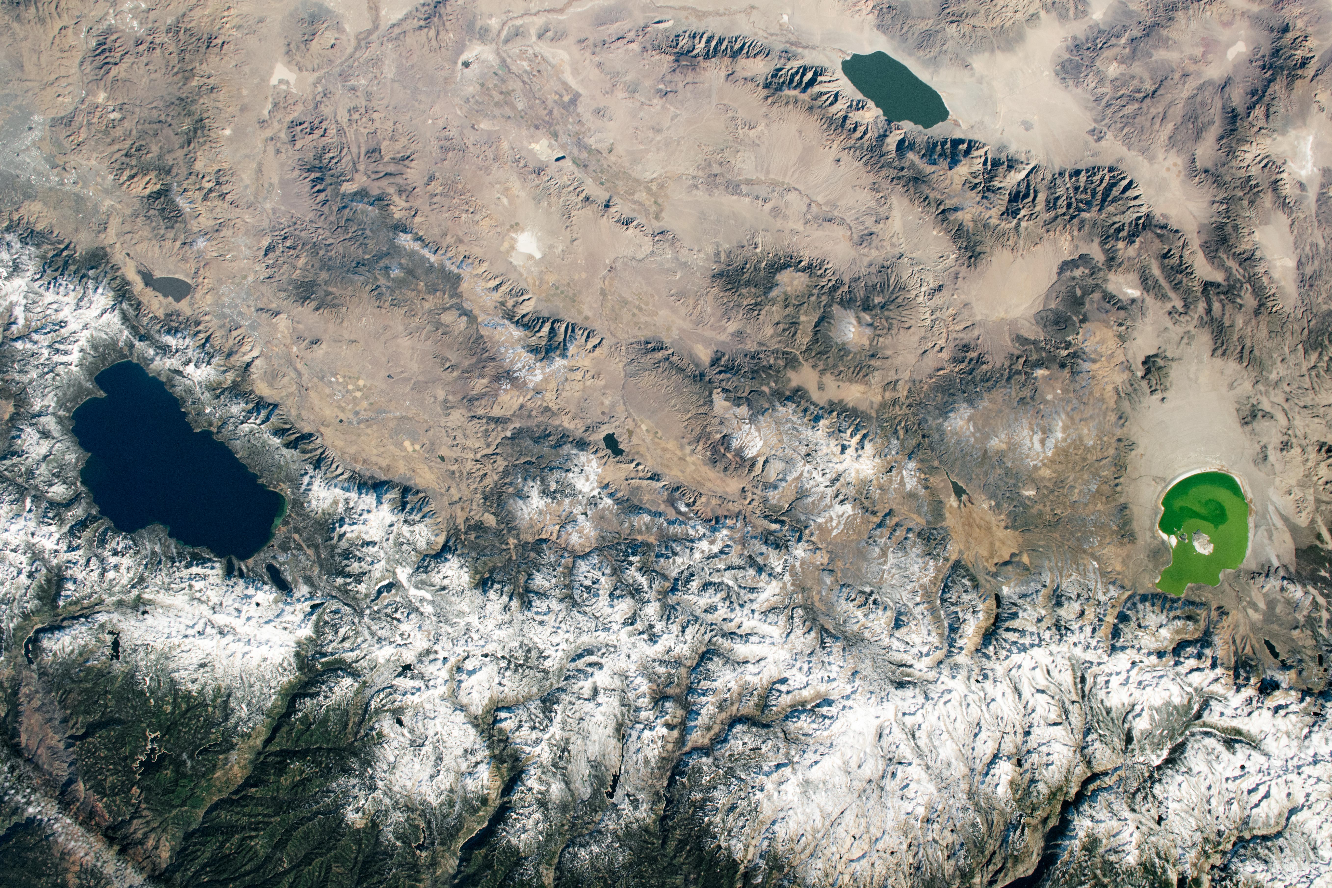
While passing over California’s Central Valley, an astronaut onboard the International Space Station looked east and shot this photograph of Lake Tahoe, Walker Lake, and Mono Lake. December snow cover accents the climatic transition between the colder, higher elevations of the Sierra Nevada and the warmer, lower valleys of the adjacent Great Basin desert.
Lake Tahoe, the largest alpine lake in North America, straddles the state line between California and Nevada. Tahoe is 501 meters (1,645 feet) deep, making it the second deepest lake in the United States (after Crater Lake in Oregon). This area, while popular year-round, is a major tourist attraction during the winter because the surrounding mountains make for great skiing and snow sports.
Located on the eastern side of the Sierra Nevada. Mono Lake is an endorheic basin; it has no outflow, so evaporation is the only natural way water leaves the system. Farther into the Great Basin lies Walker Lake. Fed by the Walker River to the north and by groundwater flow, Walker Lake also has no natural outlet. With no outflow, the lakes are rich in dissolved salts, which leads to high pH and high salinity that can fluctuate depending on their respective water inflows. Some of the historical water levels of Mono Lake are marked by lighter “bathtub rings” around the shoreline that indicate where the lake surface once stood. Past shorelines are similarly visible around Walker Lake.
Perhaps most interesting about this photo is that all three lakes are different colors. This can be partially attributed to varying water depths, but Mono Lake is unique. Because of high salinity levels and a dearth of fish, brine shrimp call this lake home while feasting on algae. When the populations of shrimp are low, the algae can thrive and turn the lake green.
Astronaut photograph ISS064-E-9397 was acquired on December 3, 2020, with a Nikon D5 digital camera using a 78 millimeter lens and is provided by the ISS Crew Earth Observations Facility and the Earth Science and Remote Sensing Unit, Johnson Space Center. The image was taken by a member of the Expedition 64 crew. The image has been cropped and enhanced to improve contrast, and lens artifacts have been removed. The International Space Station Program supports the laboratory as part of the ISS National Lab to help astronauts take pictures of Earth that will be of the greatest value to scientists and the public, and to make those images freely available on the Internet. Additional images taken by astronauts and cosmonauts can be viewed at the NASA/JSC Gateway to Astronaut Photography of Earth. Caption by Laura Phoebus, Jacobs, JETS Contract at NASA-JSC.