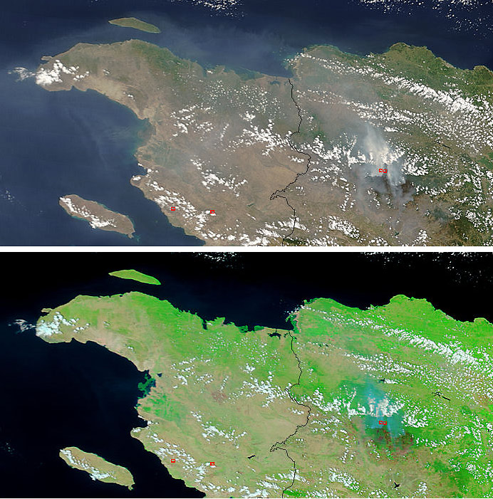
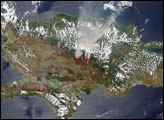
Fires burning in the Central Mountains of the Dominican Republic since mid-March have scorched as much 247,105 acres (1,000 square kilometers) in the Jose del Carmen Ramirez National Park. According to a news release from the U.S. Agency for International Development (USAID), three months of drought led to the devasating fires. The fires have produced no human casualties, but drinking water and coffee crops have been compromised. In the mountainous terrain, loss of ground cover has increased erosion and sediment build up in reservoirs and intake locations of the regional water system.
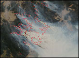
This pair of images shows the western part of the island of Hispaniola, with Haiti on the left and the Dominican Republic on the right. The natural-color image at top shows the location of active fires marked in red, while thick smoke hangs over the mountains and spreads westward. The image beneath has been enhanced using infrared observations that distinguish vegetation (bright green) from burned areas (reddish brown). Both images and fire detections were collected by the Moderate Resolution Imaging Spectroradiometer (MODIS) on NASA’s Terra satellite on April 1, 2005. The large image linked to above has a spatial resolution of 500 meters per pixel. The MODIS Rapid Response Team provides both the natural-color and false-color images at additional resolutions.
Image courtesy Jeff Schmaltz, MODIS Rapid Response Team, NASA-GSFC


